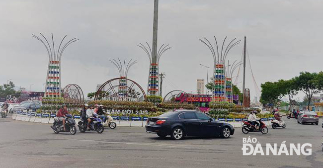
Planning for traffic project at western end of Tran Thi Ly Bridge
Da Nang People's Committee Chairman Huynh Duc Tho has approved the detailed 1:500 planning map for the traffic project at the western end of the Tran Thi Ly Bridge. The planning details will be widely announced before 12 May.
 |
| The 3-level traffic project at the western end of the Tran Thi Ly Bridge aims to reduce congestion during rush hours |
Covering an area of 131,521m2 in the wards of Hoa Cuong Bac and Hoa Thuan Dong, Hai Chau District, the project borders Binh Minh 6 Street to the north, 29 March to the south, the Han River to the east, and military agencies and residential areas to the west.
As planed, the traffic project will consist of 3 levels. The lowest level will be a 14.5m-wide, 4-lane road tunnel taking Duy Tan under the busy junctions with Le Dinh Tham and the western end of the Tran Thi Ly Bridge. The upper level on ground will be a roundabout, whilst the highest level will be a 15m-wide 4-lane steel overpass over 2 September Street.
The extended Bach Dang route, which measures 15m in width, with 2m-wide sidewalks on both sides, is planned to extend through a park north of the 2 September Peaceful Monument, linking with the 2 September Street Street.
Once it is put into use, traffic project at the western end of the Tran Thi Ly Bridge will significantly reduce the current traffic congestion at intersections nearby during peak hours, in a tandem with reducing the volume of traffic on roads leading to the Da Nang International Airport.