Digitalization of land database facilitates land information management
After many years of boosting the digitalization of land data, the Da Nang Department of Natural Resources and the Environment has basically completed the development of a system of cadastral records and land database for Da Nang.
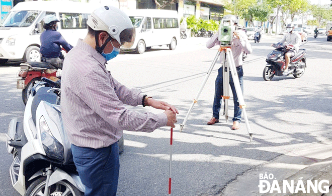 |
| Employees from the Da Nang Department of Natural Resources and the Environment are conducting geodetic surveys on Tieu La Street in Hai Chau District on January 7, 2022. Photo: HOANG HIEP |
Easy to look up land-related information
Currently, Da Nang’s residents can find it easy to access the Da Nang Land Portal at website https://ttdd.tnmt.danang.gov.vn (or the ‘Da Nang Land Information’ app downloaded on their smartphones) to look up cadastral information about the land plots they own or they want to buy.
What you need is to zoom in on the online map and select the location of the land plots that they want to know. Then all information about land plots, map sheet, area, land use purpose, etc. will appear.
Those who want to buy land can easily know basic information, especially the legal status of the land plot you want to buy and the land price. In addition, they can get an easy access to the Q&A handbook on land registration procedures, the issuance of certificates of land use rights, the ownership of houses and other assets attached to land.
Meanwhile, investors can look up information about the investment land fund, including project information, detailed planning criteria on construction density, height, setback and legal status.
According to Mr Nguyen Quang Vinh, the Director of the Information Technology Center under the Da Nang Department of Natural Resources and the Environment, account-granted officials are able to access the Da Nang Land Portal anywhere with a device having an Internet connection to handle related work instead of having to use specialized software at the office.
It can be seen that with the land portal, the many-year-lasting weakness in land information transparency has been handled, whilst investors can easily access information about the city’s investment land fund.
In November 2021, the municipal Department of Natural Resources and Environment issued regulations on building, managing and operating a land database, as well as providing the city’s land information.
Accordingly, district-level Offices of Natural Resources and Environment, and authorities at ward and commune levels, are authorized to access and exploit land databases by administrative units in service of land management.
The Regulation also stipulates cases in which public online search on the internet environment is provided with information on cadastral properties. For land users, they are provided with information on land data for the land parcel under their right to use and assets attached to the land under their ownership in the land database.
Other organizations and individuals who are in demand may be provided with land data information (except for land plot data information of defense and security agencies and units); information relating to legal documents, identity and address of land users, owners of properties attached to land; and mortgage application.
Continue to boost the digitization of land records
Da Nang has started to speed up the digitalization of land data since 2013 when the municipal government approved its VND 205 billion project on building cadastral records and land database of Da Nang during the 2013-2018 period, with an orientation towards 2020.
To date, the municipal Department of Natural Resources and Environment has basically completed the measurement and drawing of cadastral maps at the scales of 1/500, 1/1000, and 1/2,000, as well as the measurement of landmarks for resettlement projects in the city.
As a result, the Department has completed a land database with 560,400 land plots created with spatial data, 535,000 land plots with attribute information, and 409,000 land parcels have records scanned with 8 million pages of records copied for complete information integration.
The Department has also built a database and software to manage 413 land lots belonging to the land fund calling for investment at the Land Portal; as well as has reviewed the creation of data on resettlement land fund with 22,286 lots (15,039 land lots with infrastructure; 7,247 land lots without infrastructure).
It has already built software to look up land records exclusively for the city’s tax sector to serve the electronic tax interoperability.
Director of the municipal Department of Natural Resources and Environment To Van Hung said that his unit would continue to complete the cadastral map in accordance with regulations until 2025.
Heed will be paid to supplementing, updating and completing cadastral data for cases where land use right certificates are granted, land allocation and land lease cases but have not been updated in the database (in 2022), as well as regularly updating the registration and registration data of land changes according to the change and adjustment records.
Also, importance will be attached to build a database of cheap land management, and a database on land used for state offices (land used for construction of public offices), in 2022 and 2023. Emphasis will be on developing software to manage land allocation and land lease directly at the land portal in 2022, and software to manage electronic transactions on land in 2023.
Reporting by HOANG HIEP - Translating by M.DUNG