Da Nang 'arms of the sea': important trading position
From the past to the present, Da Nang's bay has always been blessed with a strategic geographical position and an important trade stature. The Politburo-adopted resolution on the Da Nang development by 2030, with a vision towards 2045 also defines a goal of building Da Nang into a seaport and urban international seaport city with its position as the nucleus of the urban chain and the growth pole of the key economic zone of the entire Central region and Central Highlands.
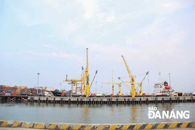 |
| The wharf system is seen at the Da Nang Port. Photo: DNO |
From the out-port's location…
Addressing a recent exhibition entitled ‘Da Nang seen from the sea through the World Documentary Heritage of the Nguyen Dynasty’ at the Hoang Sa Exhibition House, the Director of the Da Nang Department of Home Affairs, the Chairman of the Hoang Sa Island District People's Committee Vo Ngoc Dong said that, in the middle of the 16th century, Da Nang was a port for transshipment of goods and ship repair; and by the 19th century, it turned itself into the largest trading port in the central region.
Da Nang was both the focus of maritime voyages and the place where unofficial diplomatic relations took place between the Nguyen dynasty (1802-1945) in the former imperial city of Hue and Western countries.
At the same time, Da Nang was a place of ‘crucial maritime territory’, holding an important strategic position in terms of the military and national defence. Given that position, Da Nang plays a special role in economy, military and national defence under the Nguyen Dynasty.
Under the Nguyen Dynasty, the waters off Da Nang played a particularly important role because there was a large sea arm, both wide and deep, which can accommodate thousands of ships and boats, and also favourably the outside is covered with mountains so that it offer reliable shelter from strong wind and sea waves. Therefore, boats of public transport, patrol and fishing boats, and merchant ships from other countries often entered this estuary to take shelter when crossing the sea and encounter high winds.
Besides, Da Nang was located not far from the former imperial city of Hue, so it was very convenient for transportation, communication, management and control activities taken by the Nguyen Dynasty. Therefore, King Minh Mang ordered that “all merchant ships of the Atlantic countries coming here to do business are only allowed to dock at the Da Nang estuary”.
Also because of its important geo-strategic position in economic development and national defence, Nguyen Dynasty built a defence system in the coastal area with fortified citadels, fortifications and armed forces with guns, cannons for the sake of national defence.
According to Ph.D Le Tien Cong, the Director of Hoang Sa Exhibition House, the Chaya Shinroku Kochi toko zukan painting of emaki, an illustrated horizontal narration system of painted handscrolls in Japan, created in the Edo period (1603 - 1868), depicts scenes of Japanese merchant ships crossing the sea to trade with Cochinchine.
The figure on the picture depicts the journey of Japanese merchant Chaya Shinroku from headed out to the sea for a trip to Hoi An. Also, scenes of daily life in the Japanese town of Hoi An, a delegation of merchant Chaya Shinroku to the governor of Quang Nam at former Thanh Chiem town and Chaya boat travelling on a small river to a large estuary…
Marine economic hub
In the book "A brief history of Da Nang in 700 years" by researcher Le Duy Anh, it is noted that if Da Nang did not have a bay, nothing would be important. The Da Nang Bay has created a shape of maritime exchanges of the whole Central Viet Nam. Since becoming a convergence of residents, especially with foreigners entering the trading port, Da Nang had held a great commercial position, and it was not until the early 19th century, Da Nang overtook Hoi An as a trade leader.
According to Mr. Vo Ngoc Dong, looking back at history, Da Nang played an increasingly important role in Viet Nam development. With the first publication of nearly 100 documents with seal images and autographs by Vietnamese kings at the above-mentioned exhibition, these are authentic historical documents that contribute to clarifying the role and position of Da Nang's sea in history.
The strategy and policies for Da Nang development are placed in the overall socio-economic development strategy of the whole country, the central key economic region, the North Central region and the Central Coast - Central Highlands regions.
The city has close connections with development hubs and big cities in the whole country and in Southeast Asia and Asia - Pacific regions, based on the effective exploitation and use of all potentials and advantages, especially in terms of natural resources, marine economic potential, important geo-economic and geostrategic position of Da Nang in the region, and the country as a whole.
Under the Politburo-approved resolution on Da Nang development objectives by 2030, with a vision towards 2045, Da Nang will reach its target of becoming an eco, modern, smart, international city with its own identity; fast and sustainable economic development; considering raising people's quality of life to a high level is the central task; focus on developing 3 main pillars: tourism, hi-tech industry and marine economy; ensuring national defence, security, sovereignty over sea and islands, social order and safety.
In order to build Da Nang into one of the major socio-economic centres of Viet Nam and Southeast Asia with the role of a centre for entrepreneurship, innovation, tourism, commerce, finance, logistics, high-tech industry, information technology, supporting industry; one of the centres of culture - sport, education - training, high-quality healthcare, science - technology development of Viet Nam; a centre for organising regional and international events; a seaport city, an international coastal city with the position as the nucleus of the urban chain and the growth pole of the key economic region of the central and Central Highlands regions.
History of Da Nang port was set up in 1901. The development of the Da Nang port has always been associated with the development of the whole city, significantly contributing to the protection of national security and socio-economic development of the central region.
The Da Nang Port currently serves an important part in the logistics service chain of the central and Central Highlands regions as wall as the final point of the East-West Economic Corridor, connecting the four countries of Myanmar, Thailand, Laos and Viet Nam, as the main gateway to the East Sea for the whole region.
With a history of more than 120 years of establishment and development, the Da Nang port is currently the largest container seaport in Central Viet Nam, owning nearly 1,700m in length of berths with the ability to receive general cargo ships up to 70,000 DWT, ships containers pf up to 4000 TEUs and passenger ships of up to 170,000 GRT, along with modern handling and warehousing facilities.
Reporting by TRONG HUY - Translating by A.THU