Highlights in Da Nang urban space expansion
From a small, narrow urban area with poor infrastructure after the resistance war and only covering an area of about 5,600 hectares of land in 1997, by 2019, Da Nang's urban space had expanded three times. According to the Da Nang Master Plan for the 2021-2030 period, with a vision towards 2050, Da Nang urban space will be expanded to 20,814 hectares by 2030 with new urban development orientations, compact urban areas and urban underground space.
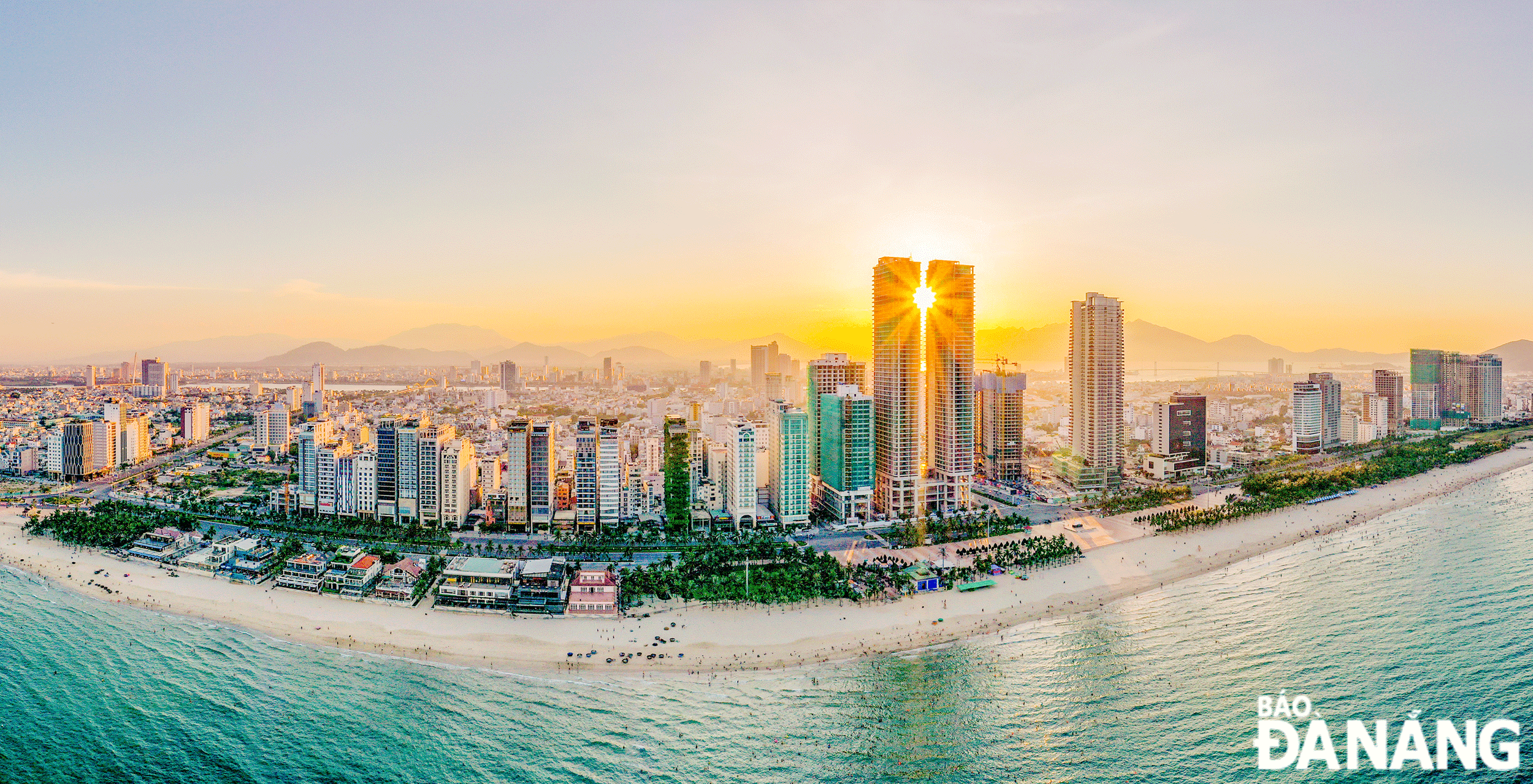 |
| Da Nang aims to become a large, ecological, smart, and unique city. Beautiful Da Nang isseen from above. Photo: HUY LE |
Imprints of urban planning
According to Director of the Department of Construction Phung Phu Phong, in addition to the facilities built before the liberation of the south and the national reunification such as the Da Nang international airport, the Nuoc Man airport, the Tien Sa port, the Han River port, the My Khe petroleum port, the Da Nang railway station, warehouse system, Da Nang had been still a city with small urban space, poor infrastructure before the city’s first master plan was approved by the Prime Minister on December 20, 1993.
By taking the early lead in urban development planning, it created the basis for Da Nang to become a centrally- run city on January 1, 1997 and to invest in many urban renovation projects. Thanks to this, urban space has expanded, the urban face has witnessed significant changes.
Facing the impressive initial development steps of Da Nang urban area, on July 15, 2003, the Prime Minister issued Decision No. 145/QD-TTg recognising Da Nang as a Class 1 urban area. From here, the city implemented a series of projects and the whole of Da Nang became a giant construction site. Da Nang urban area has developed dramatically in both form and space with nearly one-third of the total number of households having displaced, relocated, and resettled to pave way for the development of urban projects.
During that period of rapid development, the Prime Minister -approved adjustments to the Da Nang Master Plan for 2030, with a vision toward 2050 (Decision No. 2357/2013/QD-TTg dated December 4 -2013) continued the ongoing development trends that help Da Nang complete its urban face.
By 2019, Da Nang's urban area had reached more than 18,300 hectares, more than 3 times the area of the city in 1997. Da Nang has become a phenomenon of urban development. Resolution No. 43-NQ/TW dated January 24, 2019 adopted by the Politburo on developing Da Nang by 2030, with a vision toward 2045 and adjustments to the Da Nang Master Plan by 2030 , with vision toward 2045 approved by the Prime Minister in Decision 359/QD-TTg dated March 15, 2021, bring new directions for Da Nang.
This is a planning orientation that is seriously and methodically built up, consistent with development practices and new policies and orientations of the national government and the city itself.
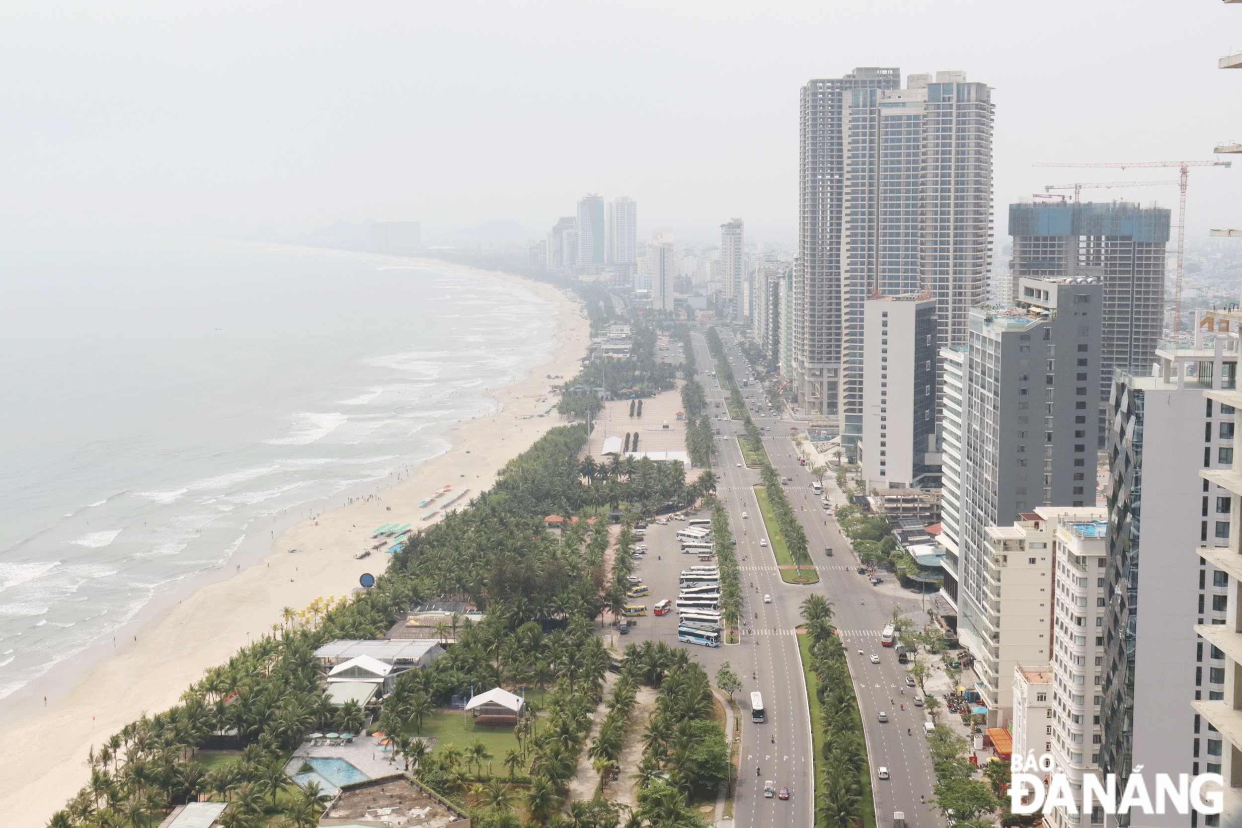 |
| A section of Vo Nguyen Giap coastal street. Photo: HOANG HIEP |
Convert the model from monocentric to multipolar
For the time being, Da Nang urban space comprises of 6 districts and part of Hoa Vang District. The city's urban land area has developed in a relatively stable and sustainable manner.
The city’s administration has completed the urban design project of the city centre area, approved the urban design supplementing the zoning plan for the central area, completed draft regulations on the management of planning and architecture, and deployed the project of reconstruction, embellishment, and urban development of the city centre for the 2023-2030 period. New urban areas have been developed to the west and northwest of the city.
In November 2023, the Da Nang Master Plan for the 2021-2030 period, with a vision roward 2050 was approved by the Prime Minister with the general goal that by 2030, Da Nang will become a seaport city and coastal urban area of international stature as the nucleus of the urban chain and growth pole of the key economic region of the Central Viet Nam - Central Highlands regions and reaching the Asian level, an ecological, modern and smart urban area, and a livable city as well. Specifically, the urban land area by 2030 will reach 20,814 hectares and Da Nang’s urban area is concentrated mainly in Hoa Vang District with an area of 6,788 hectares (accounting for 32.6% of the total land area of the urban area).
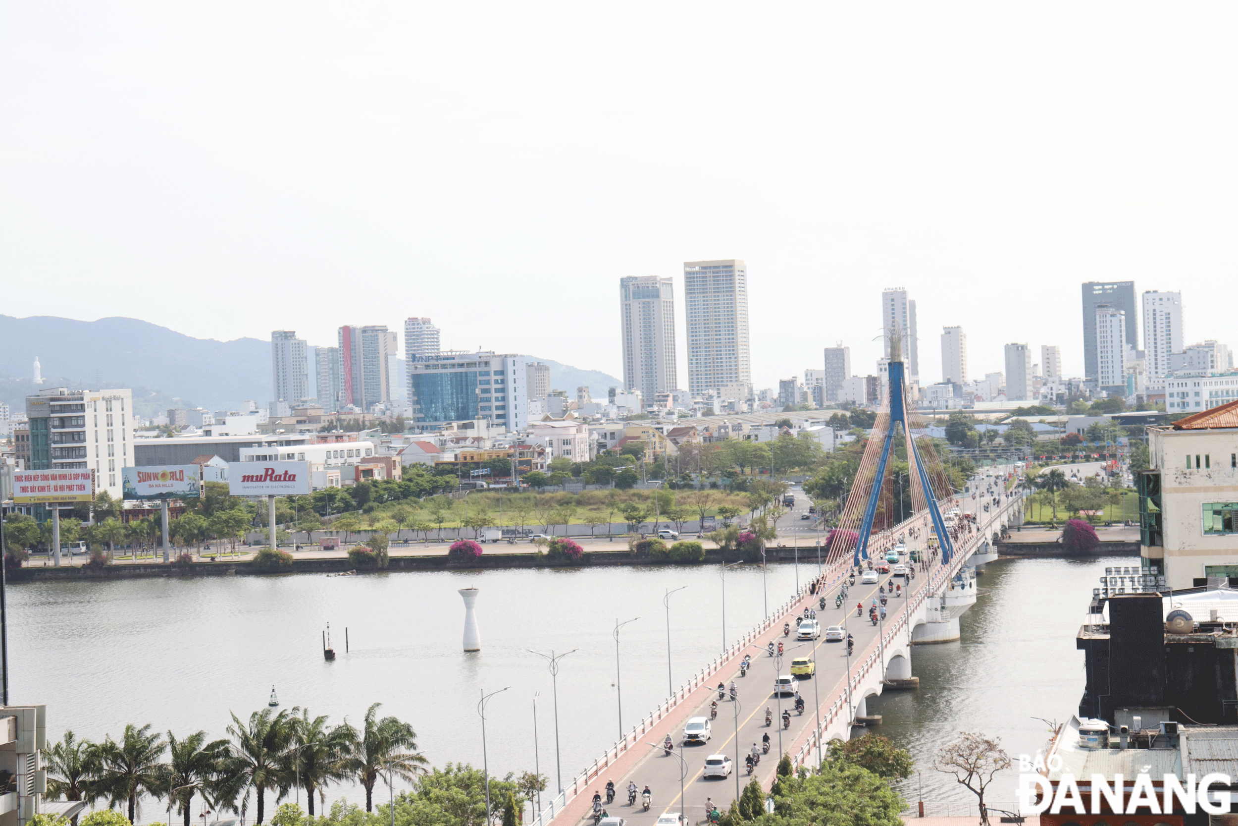 |
| Da Nang's urban space was expanded to the east bank, especially after the Han River Bridge was inaugurated. Photo: HOANG HIEP |
The existing urban area consists of 6 inner-city districts oriented for redevelopment according to a compact urban model, adding urban amenities and integrating with the public transportation system. At the same time, architectural works will be developed with modern style, with a priority on the development of spaces, works, and public services, creating the attraction of a modern and worth living commercial and business centre of high quality.
Along with that, underground space systems will be set up in public works, high-rise buildings, key traffic intersections, the urban railway station, connecting with the parking lot and underground traffic tunnel to form a complete, multi-purpose underground space.
Da Nang urban area is oriented towards multi-pole development with many compression nodes effectively integrated with the transportation network and transit points connecting the city. The urban model is transformed from spread out, unipolar, single-purpose land use, into compact urban development, multi-polar, multi-centre development, multi-purpose land use with compact urban models, eco-urban, smart urban, airport, seaport and university urban areas.
Based on natural characteristics and natural resources, the city is structured into 3 typical urban areas (water surface, green core and hillside areas) and establishes ecological zones. With the strategies and urban development plans that have been set out, it will create a modern city with an identity in the new era.
Reporting by HOANG HIEP - Translating by A.THU