Urban planning - Driving force for Da Nang's development
A project on adjusting the master plan for Da Nang’s major developments by 2030, with a vision towards 2045 orients urban development according to the structure of 3 typical urban zones, 1 ecological zone and new urban models such as compression, airport and seaport urban areas.
The implementation of the abovementioned project and zoning plans is expected to create motivation and breakthroughs for the city’s socio-economic development.
 |
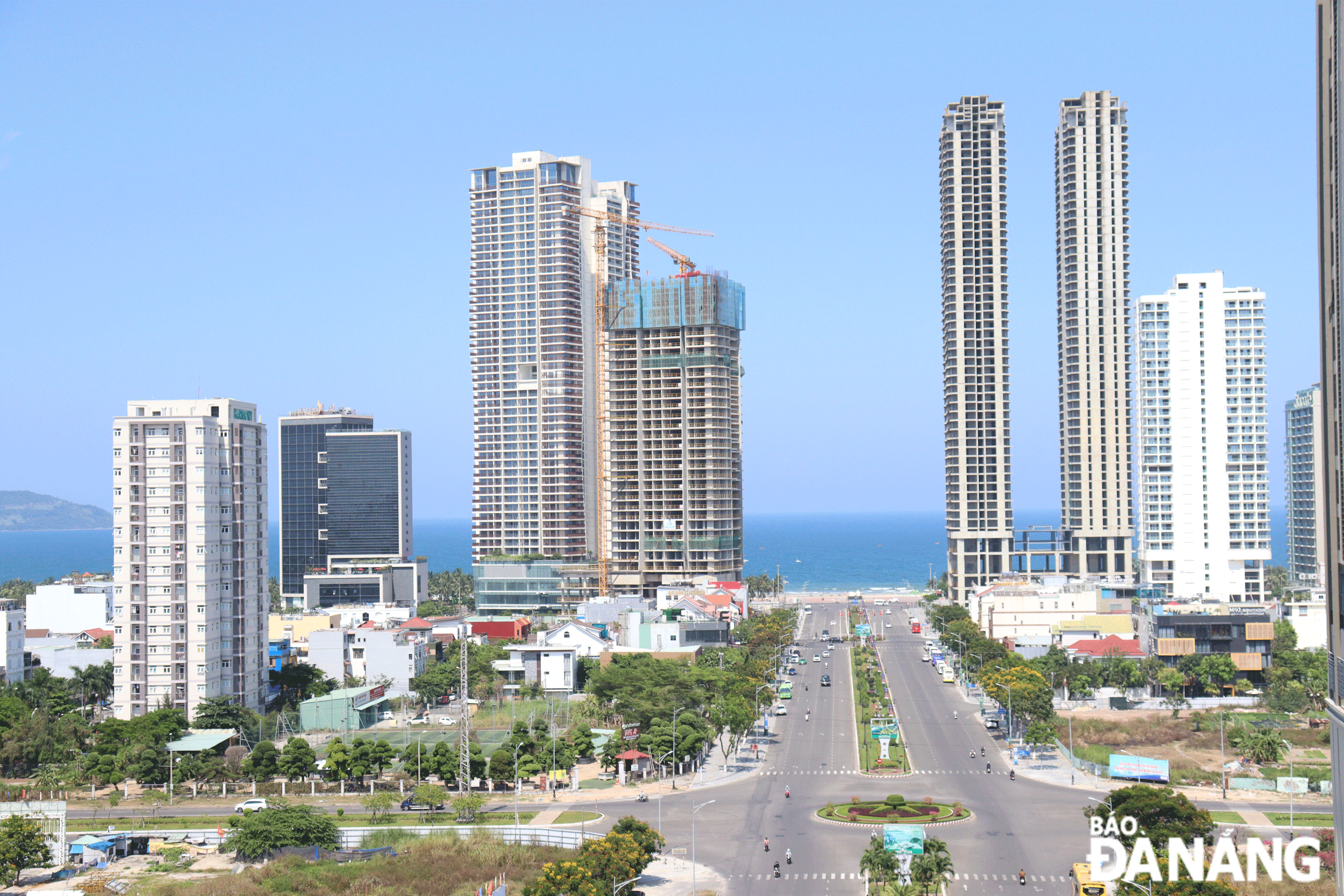
| Two clusters of buildings at the corner of Vo Nguyen Giap and Pham Van Dong streets are a modern urban highlight of Da Nang. Photo: HOANG HIEP |
New urban development models
In recent times, planning work has a very important meaning in the building and development of the city.
The project on adjusting the master plan for Da Nang’s major developments by 2030, with a vision towards 2045, approved by the Prime Minister in Decision No. 359/QD-TTg dated March 15, 2021, has oriented the city’s multi-pole urban development with many compression nodes effectively integrated with the transportation network and transit points connecting the city.
Based on natural features and natural resources, the city is structured into 3 typical urban areas, including waterfront area, green core area and hillside area.
At the same time, the ecological zone is considered as the main determining factor for urbanization boundaries, and management regulations with principles to promote tourism development potential, conserve biodiversity and promote sustainable development, moving towards an ecological and livable city.
The urban model is transformed from sprawling, unipolar development, and single-purpose land use, into a compressed urban area with multi-polar, multi-purpose development.
The project also sets out a basic development strategy for complete and synchronous framework infrastructure of airports, seaports, railways, waterways, and roads.
The city has identified priority projects to concretize the general planning project, especially those involving socio-economic and key technical infrastructure, and using a variety of capital sources (central, local, socialised) to create motivation to promote local socio-economic development.
Currently, the city is concretising the general planning adjustment project with a series of key tasks and specific items to be integrated with programmes and projects related to the field of planning, infrastructure construction, and urban beautification. Included are the Urban Development Programme in Da Nang for the 2021-2030 period, the project on building Da Nang into an environmentally friendly city for the 2021-2030 period, and the project on building Da Nang into a smart city for the 2018-2025 period with orientation to 2030.
Along with that, the city has focused on implementing 19 specific zoning planning projects and tasks, such as urban subdivision planning along the Han River and the east bank of the river, Hoa Vang District urban subdivision, airport subdivision, Da Nang coastal subdivision, and high-tech subdivision.
 |
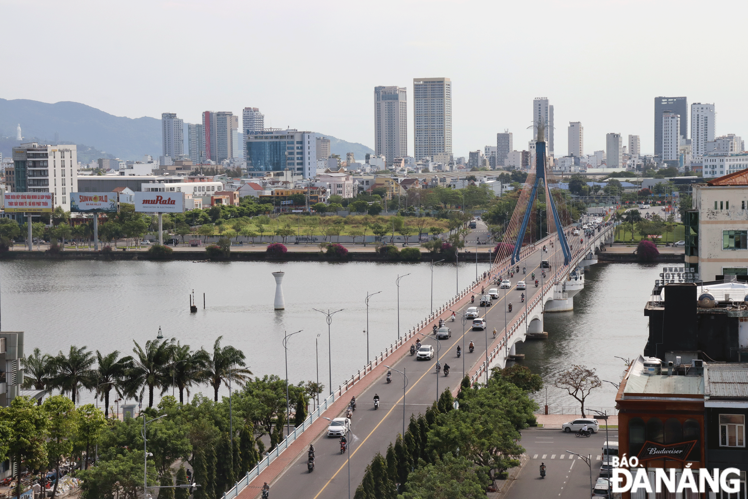
| The urban subdivision planning along the Han River and the east bank of the river is oriented to develop as the urban center of Da Nang. Photo: HOANG HIEP |
Urban center of Da Nang city
The planning project for the subdivision along the Han River and its eastern bank at a scale of 1/2000 was approved by the municipal People's Committee in November 2023 with new directions in urban restructuring, worthy of being the urban center of the city.
The 6,675ha urban subdivision is bounded by the Son Tra Peninsula to the north, the East Sea to the east, Quang Nam Province to the south, and Le Do - Nguyen Tri Phuong - Nguyen Huu Tho - Vo Chi Cong axis and Co Co River to the west. It also encompasses over 30 wards in parts of Hai Chau, Thanh Khe, Ngu Hanh Son and Cam Le districts, and the entire Son Tra District (except Son Tra peninsula).
The subdivision is dubbed an urban center, a political-administrative center, a riverside and coastal tourism gateway, a regional financial center, a national and international conference and seminar center, high quality education and training center of the Central - Central Highlands region, a cultural and sports center, and medical center in the city.
One of the outstanding features of this urban subdivision planning project is the urban highlights.
Accordingly, the central business district (CBD) is defined in the area surrounded by major roads such as Pham Van Dong, Ngo Quyen, Vuong Thua Vu and Chinh Huu with the orientation of converting to the Da Nang Industrial Park to redevelop the city and form a new CBD, becoming the new economic center of the city.
The two high-rise building complexes at the end of Pham Van Dong Street intersecting with the coastal landscape route at the corner of Pham Van Dong and Vo Nguyen Giap streets are architectural highlights, identification points and an important node on the coastal tourism landscape route.
The complex of financial centers, entertainment areas, and luxury apartments along Vo Van Kiet Street and at the corner of Vo Van Kiet and Vo Nguyen Giap streets is a highlight as a symbol of the city. Complexes of commercial centers, hotels and luxury apartments create highlights in the open space along the Han River. Notable among them are administrative - political works, theaters, museums, libraries, an international fireworks complex with high-rise commercial buildings, and the Asia Park with a 70-storey mixed-use entertainment building.
Another outstanding feature in the subdivision planning is the open space system with a combination of water surface spaces (Han River, Co Co River, Cam Le River, East Sea, Da Nang Bay) with green corridors along main rivers and large parks (Ngu Hanh Son Historical And Cultural Park, Thanh Nien (Youth) Park, Asia Park, APEC Sculpture Park, and thematic parks in the An Hai broadcasting station area, Thuan Phuoc bay urban area and in the south of Son Tra Peninsula.
The open spaces of public works and services connected to the river and sea create a harmonious and ecological natural space. In particular, the landscape space along the Han River is the main open space of the central area, connecting the administrative, economic, cultural, and tourist centers along the river and has been upgraded, renovated, and arranged.
The central square space of the city, including Dien Hai Citadel, Da Nang Administrative Center, and Da Nang Museum, is planned for investment, renovation and upgrading to be worthy of being an important open space, associated with historical and contemporary, political and cultural values, and the value of nature. This will be the place where the city's political and cultural activities will take place, serving people's entertainment needs.
Open spaces such as March 29 park, March 29 square, beach squares, parks in CBD centers will be renovated and upgraded to serve people.
Director of the municipal Department of Construction Phung Phu Phong expects that Da Nang will witness significant changes in the coming time. The quality of planning and urban development management of the city will be further improved and the goal of renovating, embellishing and reconstructing existing urban areas will be successfully implemented.
The city will overcome bottlenecks in development, thereby creating and clearing new resources for the city in accordance with new regulations and situations. At the same time, it will boost the formation and development of new sustainable urban models, develop green economy, digital economy, and circular economy in urban areas, as well as enhance its resilience and adaptation to the risks of natural disasters.
Reporting by HOANG HIEP - Translating by M.DUNG, P.TRA