Efficiency of 4-dimensional map operated on mobile devices
A 4-dimensional map platform (Map4D) on mobile devices, the first of its kind in Viet Nam, which was developed by the Da Nang-located IoT Link Co Ltd, made its debut late December 2018.
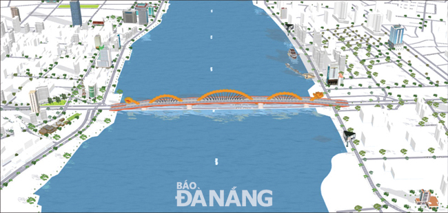 |
| The model of the Rong (Dragon) Bridge on the Map4D |
The project has received high praise from the public for its potentials in integrating many applications together for the building of smart cities. In particular, the research team consists of highly qualified engineers who are Da Nang natives.
The map displayed in real 4D was built from multiple data layers, ready for IoT connections, enabling to analyse the information and turn the data into business insight.
Visiting http://map4d.vn, and then finding the address of Co.opMart, located in Thanh Khe District), users will see the screen show up a three-dimensional model simulating this venue. By clicking here, they will be immediately taken to a “virtual” Co.opMart just like the real-life one. With the mouse drags, users can explore everything they want about this location. Information on certain products on sale at the supermarket and their prices will be displayed on the screen.
The “virtual” Co.opMart is one of the applications of Map4D. Up to now, this has been the only online map in Viet Nam showing the full width, heighs, depth, and the dimension of time.
Mr Trinh Cong Duy, the Deputy Director of the Software Development Centre under the University of Da Nang, who is also the research group leader, said, he and his colleagues came up with the Map4D idea in late 2015.
At that time, the Map4D developers wanted to create a large-scale information technology product made by Vietnamese nationals themselves for domestic use.
The data warehouse for the made-in-Viet Nam Map4D is stored at the Viet Nam Data Centre so as to minimise the possibility of information leakage and insecurity.
Built on multiple data layers, Map4D is the foundation for integrating software products from start-up groups and software businesses.
Currently, the IoT Link company is developing the Da Nang cadastral map. With this application, users can find it easier to access land information, planning, and the construction history of any venues in the city.
The cadastral map also features the chatbot technology with the aim of supporting users to find information quickly.
As for its other useful features, the map also integrates many other applications for building smart cities such as infrastructure management and urban landscapes.
Noticeably, the Ngu Hanh Son District- located Cocobay Entertainment and Tourism Complex, has already applied Map4D in building models of urban areas.