Sarika - most dangerous storm in years en route
Storm Sarika is expected to enter the Tonkin Gulf and head toward Viet Nam’s coastal provinces from Quang Ninh to Nam Dinh on October 19 with winds up to 165km per hour, according to the National Forecast Hydrometeorological Forecast Centre.
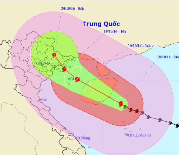 |
| The predicted movement of the storm |
The Director of the centre, Hoang Duc Cuong, said Sarika was forecast to be the most dangerous and strongest storms to hit Viet Nam in recent years.
This is the 7th storm to hit the East Sea this year.
The storm was located 190km north-northwest of Hoang Sa Archipelago at 4am of 18 October, with wind speed in the eyewall of the storm reaching 165km per hour.
It was moving in the west -northwest direction at a speed of 15km per hour.
The storm was predicted to hit offshore northeastern localities of Viet Nam at 4pm of October 19, according to the centre.
The centre warned that the storm would bring heavy rain of 200-300mm for northeastern and northern central localities. The rains could bring floods to these localities and mountainous areas are warned of flash floods and landslides.
Wind speed in the storm’s eyewall could reach from 135 to 150km per hour with stronger gales from 184 to 201km per hour, according to the forecast centre.
All administrations and agencies have been placed on alert.
The National Steering Committee for Disaster Prevention and the National Steering Committee for Search and Rescue Operations have held a teleconference with representatives of the authorities of 22 localities from Hai Phong to Quang Binh to discuss measures to cope with the storm.
(Source: VNA/ Da Nang Today)