Tropical depression to enter East Sea
A tropical depression recently formed near the Philippines is forecast to head toward the East Sea, carrying heavy rains and rough seas.
 |
|
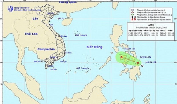
A map detailing the route of the tropical depression on November 24 and 25, 2016. The National Center for Hydro-meteorological Forecasting. |
The depression formed in the sea area just east of the southern Philippine islands Thursday afternoon before heading northwest towards the East Sea, according to the National Center for Hydro-meteorological Forecasting.
The system made landfall in the southern region of the Philippines around 1:00 am the same day, packing winds of 40 to 50kph and squalls up to 74kph.
The tropical depression is forecast to continue traveling northwest at an average velocity of 15 to 20kph, into the northeastern area of the Sulu Sea, located west of the Philippines, by 1:00 pm on Friday.
All vessels operating in central areas of the East Sea have been advised to monitor the storm’s development and take appropriate preventative safety measures.
(Source: Tuoitrenews)