Typhoon Kaitak looms in East Sea, cold spell strengthens in the north
The tropical depression active east of the Philippines has picked up strength and become typhoon Kaitak.
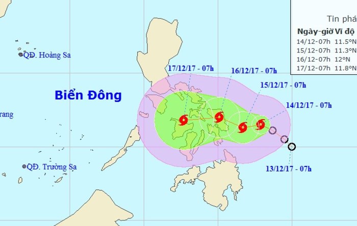 |
| Typhoon Kaitak’s predicted path in the next 24-48 hours. — Photo from the National Centre for Hydro-meteorological Forecasting |
In the next 24 hours, the typhoon is expected to slowly move westward into the East Sea at the speed of 5km/h, according to the National Centre for Hydro-meteorological Forecasting.
By 1.00pm 14 December, the typhoon was 230km away from the eastern Philippines’ coastline, with wind reaching gale 8 (60-75km/h) near its centre. It is forecast that in the next 48-72 hours, the typhoon will maintain this pace on its west-bound journey.
The national forecasting agency warns that typhoon Kaitak’s “developments are complicated” and the public is urged to closely follow updates on the typhoon.
In addition, the centre also said another wave of cold air is pushing south across the northern and north-central regions late on 14 December night.
The areas affected by the cold will see a drastic temperature drop and strong northeastern winds of gale 3 inland and gale 4-5 over seas.
The incoming cold air is characterised by low humidity, so drizzles and thick clouds in the past few days would lift for sunshine and dryer air. The lows are predicted at 8-11 degrees Celsius at night around the delta and at 4-7 degrees in the mountainous areas. Mountainous areas might also experience frost and hoarfrost.
(Source: VNS)