2 tropical depressions formed in East Sea, one forecast to strengthen into storm
According to the National Centre for Hydro-Meteorological Forecasting (NCHMF), a tropical depression recently formed in the East Sea area is predicted to develop into a storm, and to hammer the central region with winds ravaging at 60 kph.
 |
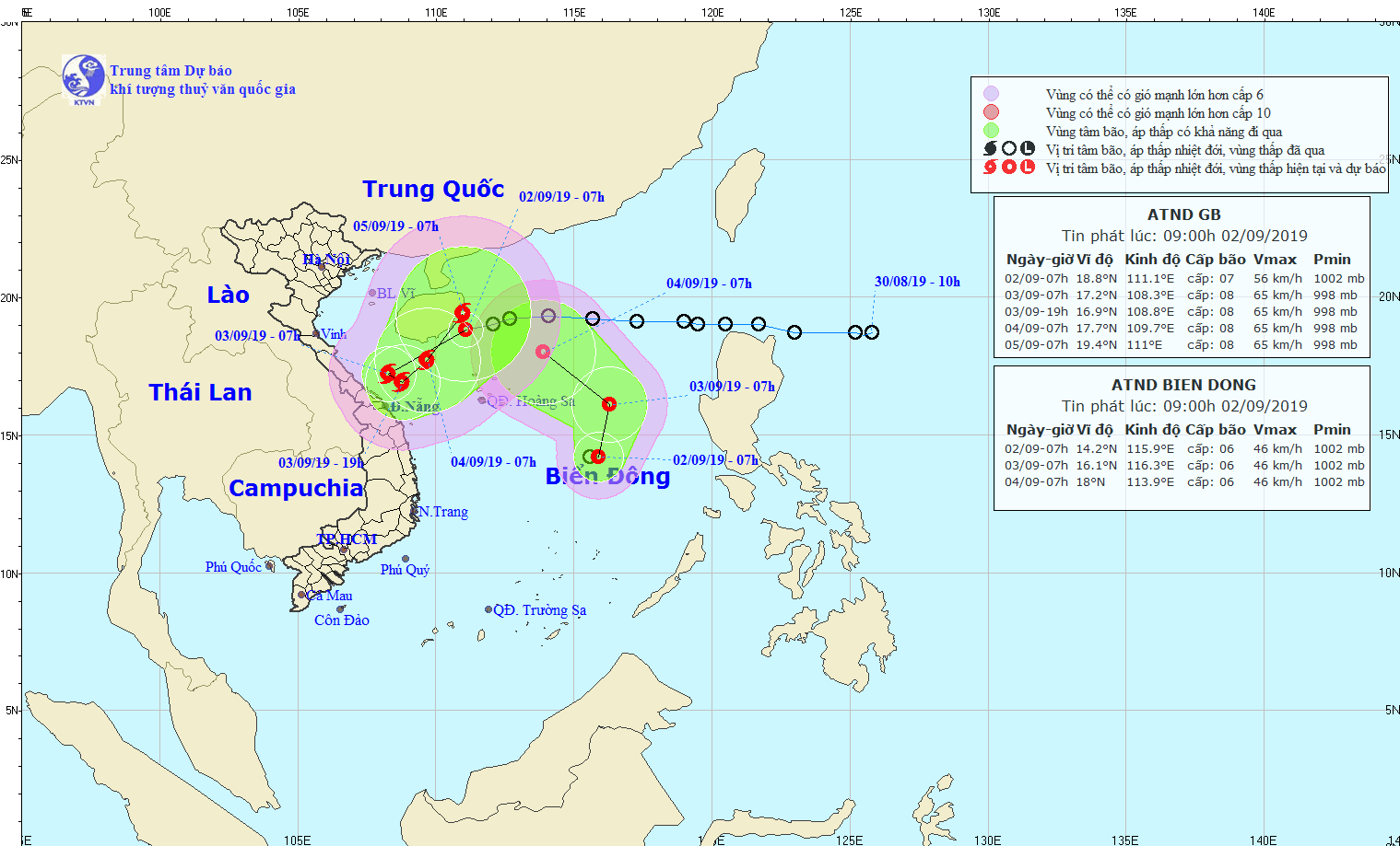
| The expected path of the two depressions (Photo: NCHMF) |
At 7.00 am today, 2 September, the depression was located at latitude 18°8’N and longitude 111°1’E, about 70km east of China’s Hainan Island, packing strong winds of 40 and 60 kph near its centre (level 6/7), and gusts of level 9.
Over the next 24 hours, the depression is expected to move in a west-southwest direction at a velocity of 15 to 20km an hour, and is likely to turn into storm.
At 7.00 am tomorrow, 3 September, the storm’s position is predicted to be at latitude about 17°2’N and longitude 108°3’E, about 100km east of coastal areas from Quang Tri to Quang Ngai provinces, with maximum winds of 75 kph (level 8) and squalls of level 10.
Under the effect of the current depression and soon-to-be-developed storm, the Da Nang area and elsewhere along the central coast between Quang Tri and Binh Dinh provinces, is experiencing heavy to very heavy rains and strong winds at level 7/8 until 6 September.
In addition, sea waters of the coastal area will see strong winds at level 10, sea waves from 3 to 4m high, and rough seas.
Also on Monday morning, another tropical depression was formed in the East Sea area.
The depression was at latitude 14°2’N and longitude 115°9’E at 7.00 am today, carrying gusts of between 40 and 50 kph, according to NCHMF.
Over the next 24 hours, the depression is expected to move in a north-northeast direction at a speed of 5 to 10km an hour.
At 7.00 am on 3 September, the depression's location is expected to be at latitude about 16°1’N and longitude 116°3’E, about 400km east of the Hoang Sa Archipelago, with maximum winds of 50 kph (level 6).