Tropical depression forecast to bring heavy rain to the city early next week
A tropical depression is moving into the East Sea after crossing the Luzon Island in the Philippines, and it is forecast to form a storm next week, the National Centre for Hydro-Meteorological Forecasting has warned.
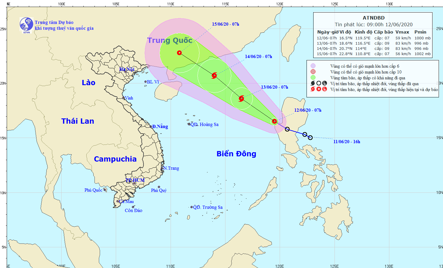 |
| The expected path of the tropical depression (Source: The National Centre for Hydro-Meteorological Forecasting) |
Forecasters said at 7.00am today, 12 June, the tropical depression was located at latitude 16°5'N and longitude 119°5'E, about 90km west of the Luzon Island in the Philippines, with winds near its centre at 50-60 kph.
Over the next 24 hours, the tropical depression is forecast to move in a northwest direction at a velocity of 15 km an hour, and it likely to become storm.
At 7.00am tomorrow, 13 June, the storm’s position should be at latitude 18°6'N and longitude 116°5'E, about 470km east-northeast of the Hoang Sa Archipelago. The strongest wind speed near its centre is forecasted to be 60-90kph at levels 8-9.
Due to the effects from the tropical depression which potentially forms a storm, north and mid-central regions, including Da Nang, will brace for scattered to moderate showers, and strong winds between 13 and 15 June.
In addition, heavy rain-triggered flash floods, landslides, lightning, whirlwinds and hail are predicted to tear through some mountainous areas in the north-central regional localities.
In order to proactively respond to tropical depression and heavy rain, the Central Steering Committee for Natural Disaster Prevention and Control is urging the authorities of coastal localities from Quang Ninh Province to Da Nang to issue warnings about landslide-prone areas so that residents can move to safer locations.
By HOANG HIEP - Translated by MAI DUNG