Over 4,000 homes submerged under water as torrential downpours lash Da Nang
As of Saturday evening, more than 4,000 homes across suburban Hoa Vang District in Da Nang have been flooded, whilst transport services and power supplies there have been disrupted as areas have been hit by a deluge of heavy rainfall since 6 October.
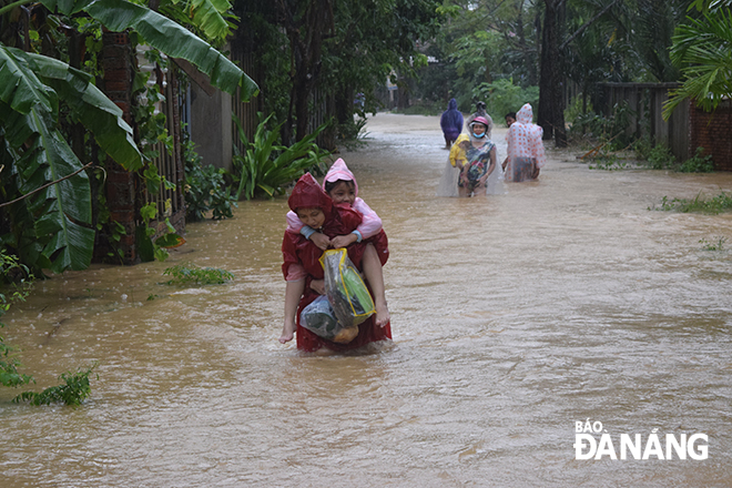 |
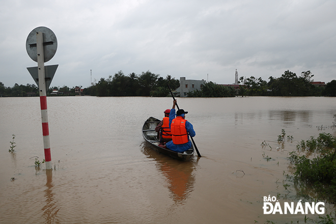
| People in the flooded La Bong Village, Hoa Tien Commune, Hoa Vang District are moving to a safe shelter |
In all, over 2,700 people living in the communes of Hoa Nhon, Hoa Phong, Hoa Khuong, Hoa Chau and Hoa Tien which are among the worst-hit areas in Da Nang have been evacuated. However, thousands of people are living in areas that are at significant risk to flooding, with water levels expected to keep rising for the next 24 hours.
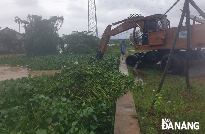 |
| Local authorties in Hoa Tien Commune clearing drainage ditches, and collecting water hyacinths and rubbish at rainwater inlets on road surface, in order to ensure efficient drainage of rainwater. |
Prolonged heavy rainfall during the week has triggered landslides along some sections of the DT601 and DH409 routes in Hoa Vang District.
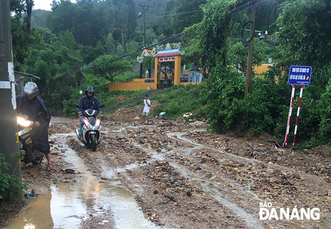 |
| A section of the DT601 route running through Quan Nam 3 Village, Hoa Lien Commune, has been severely affected by a damaging landslide triggered by recent heavy rainfall. |
In wake of a massive volume of downpours ceaselessly battering Da Nang and elsewhere in Central Viet Nam over recent days, the water levels on Vu Gia and Tuy Loan rivers which flows through Hoa Vang District have continued their upward trend.
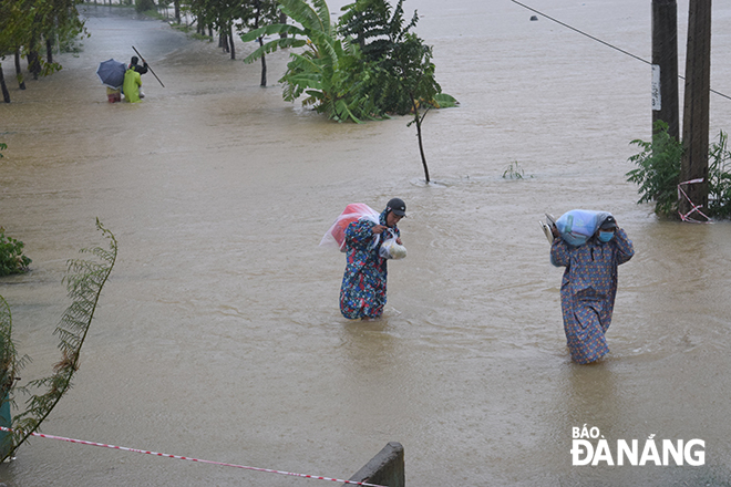 |
| A road leading to Tay An Village, Hoa Chau Commune, has turned into a river, following nearly a week of torrential downpours. |
At 4.00pm on Saturday, the water level of the Vu Gia River rose to 9.29m, 0.29m higher than flood alert level 3. Meanwhile, the water level of the Yen River at the An Trach Pumping Station increased to 6.11m.
From Saturday evening, the Song Bung 4 hydropower reservoir on the upstream of the Vu Gia River has released floodwaters from its spillways with a total amount of 1,270m3/sec, whilst the A Vuong hydropower reservoir has discharged water up to 618m³/sec and the Dak Mi 4 hydropower reservoir released water 92 m³/sec in accordance with the national government-approved water discharge regulations.
Shocking images show the scale of the devastation caused by a nearly week of heavy downpours.
 |
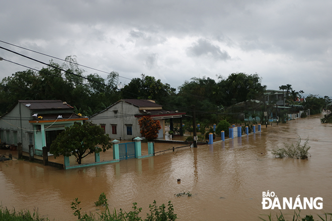
| Hoa Tien Commune has been one of the worst-hit areas. |
 |
A fresh prediction by the Mid-Central Region Centre for Hydro-meteorological Forecasting shows that the water levels of the Vu Gia and Thu Bon rivers are likely to increase significantly, posing a severer flooding threat to downstream and low-lying areas across Da Nang.
 |
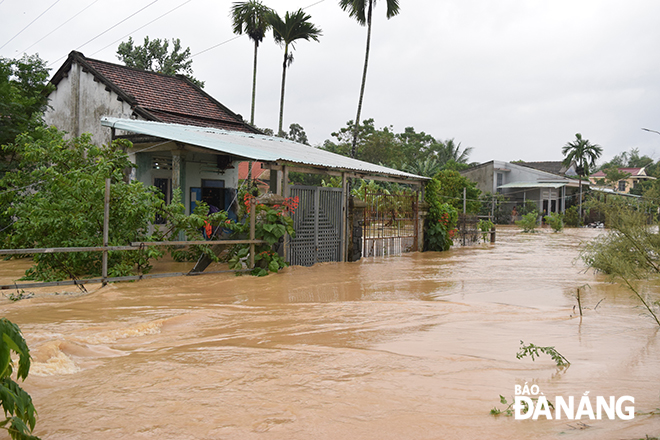
| Homes in Hoa Khuong Commune have been surrounded by flood waters |
 |
| Picture taken at a flooded area in Hoa Khuong Commune |
By HOANG HIEP, VAN HOANG - Translated by M.D