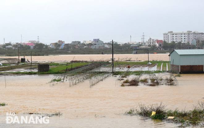
Heavy rain causes flooding in many areas across Hoa Vang District
Floodwater discharged from hydropower dams on the upstream of Vu Gia and Thu Bon rivers in the light of prolonged stretches of ceaseless torrential rain was blamed for flooding many downstream areas in Da Nang’s Hoa Vang District on Wednesday.
 |
| Floodwater penetrating into some of the La Huong vegetable growing village’s parts Hoa Tho Dong Ward, Cam Le District |
The heavily soaking weather is being triggered by the combined effects of enhanced cold front combined with high turbulence in the easterly wind condition.
At Wednesday noon, water surged and spilled over some concrete roads in Hoa Vang’s District’s Hoa Tien Commune. Also getting stuck in the same inundation trouble, a primary school in Le Son 2 Village in this low-lying commune closed on Wednesday morning as a massive amount of water flooded its entrance.
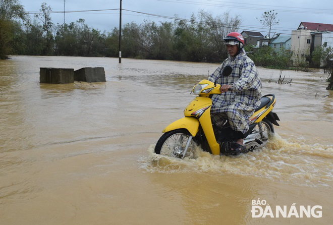 |
| A flooded section of the DH 409 road in Hoa Tien Commune, Hoa Vang District at Wednesday noon |
In the coming hours, the water level of the rivers in localities from Quang Tri to Quang Nam will continue with upward trend, the Viet Nam's National Hydrology Meteorology Forecast Centre (NCHFM) warned.
From now into Thursday, 12 November, Quang Binh, Quang Tri and Northern Quang Ngai are heavily soaked with the total average rainfall of ranging 100 -200mm, even over 250mm in some of their parts.
Likewise, Thua Thien Hue, Da Nang to Quang Ngai are bracing for the rain accumulation of 150- 300mm.
The lesser rain amount hovering at 50-100mm is measured in Ha Tinh and Southern Quang Ngai.
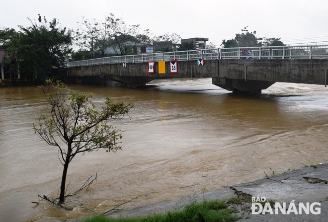 |
| The water level of the Tuy Loan River rising at rapid pace |
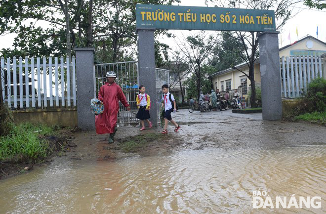 |
| Floodwater approaching the entrance to a primary school in Hoa Tien Commune on Wednesday morning |
With regard to the tracking of the typhoon Vamco, it is due to make landfall in Polilio Island this evening and hit rice-producing provinces north of the capital before exiting the Philippines’ main island of Luzon on Thursday, a state weather forecaster projected.
Residents in coastal communities, who are expecting up to a 3m storm surge, were ordered to leave their homes.
Vamco is forecast to enter the East Sea tomorrow, 12 November, with winds of up to 133 km/h, and will then hit Central Viet Nam on 14 - 15 November.
At 7:00 am on Saturday, 14 November, the centre of Vamco lay around latitude 15°6’N and longitude 111°7’E, about 180 km south of the Hoang Sa Archipelago with the strongest sustained wind of level 12 near its centre, and a gust of level 15.
By HOANG HIEP- Translated by A.T