Typhoon Vamco could threaten Central Viet Nam on Sunday
Vamco entered the East Sea on Thursday morning after having soaked and lashed provinces in the Philippines' main Luzon island overnight, becoming the 13th storm to hit Viet Nam this year. Like previous typhoons, Vamco has a high likelihood of heading for Central Viet Nam, which has reeled from the trail of destruction brought by storm after storm since early last month.
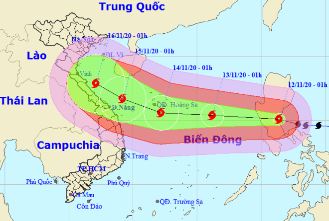 |
| Vamco tracking map (NCHFM) |
At 7:00 am on Saturday, 14 November, the centre of Vamco lay around latitude 15°6’N and longitude 111°7’E, about 180 km south of the Hoang Sa Archipelago with the strongest sustained wind of level 12 near its centre, and a gust of level 15.
By Sunday morning, 15 November, Vamco could reach the Vietnamese coastline from Ha Tinh to Quang Nam provinces, Viet Nam's National Center for Hydro-meteorology Forecasting (NCHFM) said.
Meanwhile, based on projections made by international weathering forecasting agencies, Vamco could make landfall over Ha Tinh and Quang Binh provinces on Monday, 16 November.
Typhoon Vamco raged in the Philippines' main Luzon island overnight, killing one person while three more are missing, the local disaster agency said on Thursday.
Vamco, with maximum sustained winds of 155 km per hour (96 miles per hour) and gusts of up to 255 kph (158 mph), made landfall three times starting on Wednesday night in Quezon province, south of the capital Manila.
Vamco, the 21st cyclone to hit the Philippines this year, battered the Philippines still reeling from Molave, the world's most powerful typhoon this year that killed 25 people and destroyed thousands of homes early in November.
Viet Nam’s Central Steering Committee on Natural Disaster Prevention and Control and the National Committee for Disaster Response, Search and Rescue have urged coastal central cities and provinces from Thanh Hoa to Binh Thuan to actively respond to Vamco.
The storm is now bringing up looming menaces at sea, with vessels operating in the affected zones bearing high risks from gusts, NCHFM warned.
In Da Nang, as a result of prolonged stretches of ceaseless torrential rain, the water level of Yen River, which runs through Hoa Vang District has maintained its upward trend.
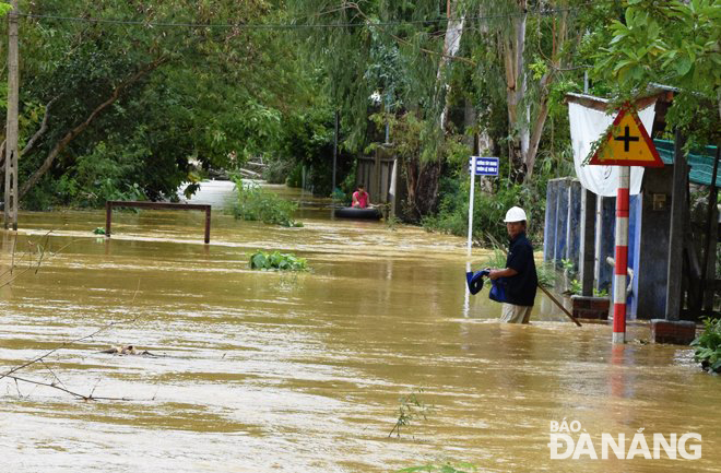 |
| A residential area in Hoa Tien Commune looded on Thursday morning |
On Thursday morning, water surged and spilled over some concrete roads and residential quarters in Hoa Vang’s District’s Hoa Tien Commune.
Of special note, warnings on landslides and floodings have also been issued for some vulnerable mountainous and low-lying areas, respectively, in wet weather-soaking central regional localities from Quang Binh and Quang Ngai.
Floods and mudslides over the past month have killed at least 160 people in Central Viet Nam, left dozens missing and damaged 390,000 houses.
By HOANG HIEP – Translated by A.T