Interesting things about Covidmaps Da Nang
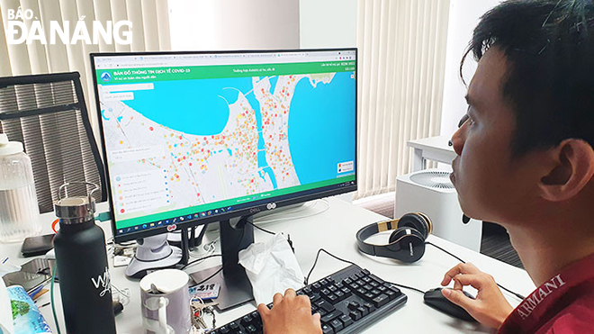
Many Da Nang residents, during this COVID-19 wave, are now in the habit of openning the Da Nang COVID-19 epidemiological information map (Covidmaps) at https://covidmaps.danang.gov.vn to update the developments of the coronavirus.
 |
| The Covidmaps team discuss the application mapping technology |
On the spotlight of the Covidmaps are the vivid display of ‘red, yellow, green’ areas, patient information, warning areas, blockaded locations nearby, help-lines and the locations of checkpoints and essential sales points, all of which are illustrated in a easy- to- find manner on the app with tiny colored dots and symbol.
Covidmaps has become a useful and familiar tool even though it was put into operation not long ago. Covidmaps Da Nang is implemented by the Da Nang Public Service Portal 1022 under the Da Nang Department of Information and Communications and the BusMap, now renamed as Phenikaa MaaS.
Behind this interesting map is interesting stories.
Le Yen Thanh, the founder and CEO of BusMap, who is widely known by many as ‘a guy born in 1994 who rejected Google’s job invitation and successfully raised million-dollar startup capital’, is responsible for ensuring the technology for Covidmaps Da Nang.
In his recent interviews with DA NANG Newspapers about the process and emotions whilst creating such a socially- meaningful product, effectively supporting pandemic prevention and control, Thanh said that it is both pressure cum great motivation for Covidmaps to become more and more perfect.
In August 2020, Da Nang was in need of an effective solution to quickly inform the general public of the coronavirus developments and high-risk exposure sites, instead of manually announcing them through text. This task was assigned for BusMap.
After round of intensive discussion, the idea of Covidmaps Da Nang was formed. The team, at that time, consisted of map developers from BusMap and more than 20 employees from 1022 Da Nang who are responsible for inputting information into the system.
After one week, the first version of Covidmaps Da Nang was born and introduced to Da Nang people for use, receiving a positive response from users.
 |
| Programmers are involved in the building of Covidmaps. |
Da Nang is the first locality to deploy the COVID-19 epidemiological information map and is also the place where Covidmaps are most fully completed.
Versions designed for other localities are customised according to their requirements, but all of them come from the idea and operation of Covidmaps Da Nang.
The Covidmaps Da Nang version shows off a lot of new components and features that are constantly updated to serve the local government's COVID-19 prevention and control and bring necessary information to the general public
In the near future, Covidmaps is expected to deploy more features towards the ‘new normal’ such as becoming a health and vaccination map, and hopefully can expand into other areas.
Updating data is a very important step to ensure accurate information on the map. This stage, 1022 Da Nang takes care of it very well and is always makes updates on the pandemic situation in a timely manner. Thanks to this, BusMap only needs to focus on operating the technology side to ensure the stability of the map.
There are occasions when the daily number of visitors is very large, more than 800,000 people, accounting for over 50% of the Da Nang population. This fact has prompted BusMap to ensure technological effectiveness for the sake of the app’s smooth operation.
In addition, BusMap is supported by 1022 Da Nang to be able to operate the map regularly and smoothly. Leaders of the municipal Department of Information and Communications have also made many suggestions to BusMap on improving the features and upgrading Covidmaps better. The entire Covidmaps’s deployment infrastructure is supported by the Da Nang Data Centre.
Fully aware of the people are the main target, the map is designed as a easy- to -manipulate and use tool.
In particular, Covidmaps is designed as a webapp - no need for people to install additional applications, and it is easy to access and use even on smartphones. Covidmaps is also regularly updated according to people's feedback through the comment feature available on the map.
 |
| Le Yen Thanh is responsible for developing the technology for Covidmaps Da Nang . Photo courtesy of Le Yen Thanh |
The core technology of the Covidmaps Da Nang is map technology - bMap, one of the mapping technologies to have developed by Phenikaa MaaS. Thanks to this mapping technology, Covidmaps can operate and respond to a large number of daily visits, which can help display epidemiological locations in real time as there is the input of 1022 Da Nang -offered data.
Without this mapping technology, Covidmaps would have to bear huge operating costs in terms of maps and data. In fact, the use of Google Map's maps requires the payment of up to billions of dong per month worth of fees. Meanwhile, Phenikaa MaaS sponsored this technology for free of charge for Da Nang, thereby helping the city save a lot on the cost of operating Covidmaps.
|
Covidmaps has earned a berth the top 10 at the HCMC Innovative Solution COVID 202 (HIS-COVID 2021) contest launched by the HCMC Department of Science and Technology. In addition, Phenikaa MaaS also received a certificate of merit from the Da Nang People's Committee for its outstanding contribution to the city’s COVID-19 combat. Phenikaa MaaS is, for the time being, collaborating with 1022 Da Nang to deploy a wireless camera solution that scans the QR code of travel passes, making it possible to control all travel documents without close contact between inspection staff and commuters. |
Reporting by THU HOA – Translating by A.T