Overflowing rivers of Yen, Vu Gia and Cam Le cause floods
On Friday morning, October 8, some low-lying parts of Quang Nam Province’s Dai Loc District downstream the Vu Gia River were flooded as a result of rising water levels. The similar flood situation was also reported in low-lying and riverside areas in Hoa Vang District’s Hoa Tien Ward and Cam Le District due to rising water levels of Yen and Cam Le rivers.
In its latest bulletin, Viet Nam’s National Centre for Hydro-Meteorological Forecasting said, water levels on the Vu Gia River are high and are increasing due to the storm No.7. The water levels of the Vu Gia River at the Ai Nghia Hydrological Station were recorded at 8.28m at 7am today, above alarm level 2 by 28cm.
This noon, water levels of the Vu Gia River at the Ai Nghia Hydrological Station likely reached peak level at 8.35 m, above alarm level 2 by 0.35 m, then down. At 1pm today, the water levels were expected to drop to 8m.
Weather forecasters have issued warnings of flash floods and landslides in mountainous areas, and floods in low-lying and riverside areas, in central coastal localities from Quang Tri to Quang Ngai, and Kon Tum.
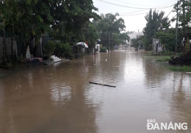
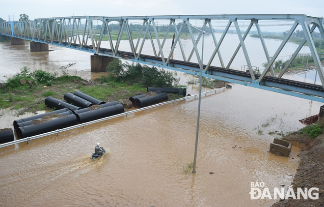 |
| The Cam Le River overflowing its banks, flooding a section of a riverside road. Photo: HOANG HIEP |
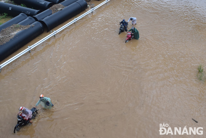 |
| Some motorbikes’ engines suck in water and stall while driving through flooded roads. Photo: HOANG HIEP |
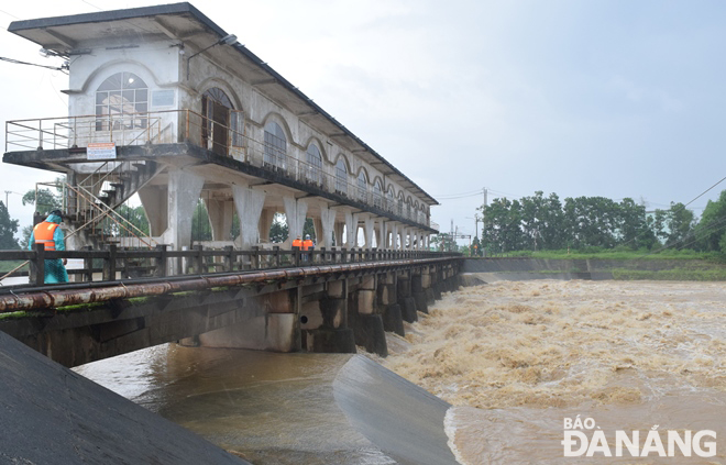 |
| At 10am on October 8, flood waters flowing from Vu Gia River to Yen River through the An Trach Dam. Photo: HOANG HIEP |
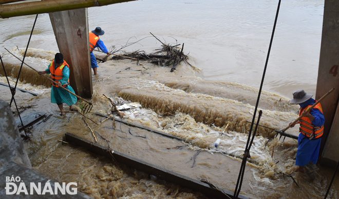 |
| Employees from the Da Nang Irrigation Exploitation and Management Company clearing trash at An Trach Dam so that flood waters can rapidly move downstream. Photo: HOANG HIEP |
 |
| A road leading to the Ngoai Thuong Bridge, Ai Nghia Town, Dai Loc District, Quang Nam Province is submerged in water. Photo: PV |
Reporting by HOANG HIEP - Translating by M.DUNG