High winds and rough seas bring big waves crashing Da Nang ashore
At 6:00 pm on Sunday, December 19, storm Rai’s centre was about 200km off the coast of Quang Ngai Province, and about 180km off the southeast coast of Ly Son Island, packing maximum sustained winds at level 12, and the gusts reaching level 14, according to Viet Nam’s National Centre for Hydro-meteorological Forecasting.
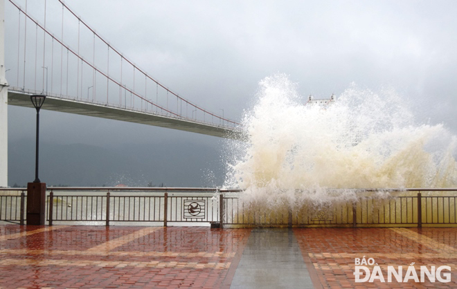 |
| Large waves crashing the embankment on Nhu Nguyet Street, Hai Chau District during more strong winds on Sunday. Photo: HOANG HIEP |
In its latest weather bulletin, the National Center for Hydro-meteorological Forecasting says that at 4:00pm on Monday, December 20, the storm’s will be positioned at about 200km north of the Hoang Sa Islands with the maximum sustained winds in the area near the center at levels 10 to 11, and the gusts as high as level 13.
The storm is then expected to downgrade to a tropical depression while continuing to move toward the northeast at about 15-20km per hour.
Due to the strong influence of the storm and cold front, the north of the East Sea could see gradually increasing strong winds at levels 7 to 8, gustiness of up to level 10, the waters of the Hoang Sa Island will witness gradually increasing high winds at level 8, then increase to levels 9 to 10, the area near the storm’s centre will see strong winds at levels 11 to 12, the gusts as high as level 14, and experience rough seas with waves as high as 6-8m.
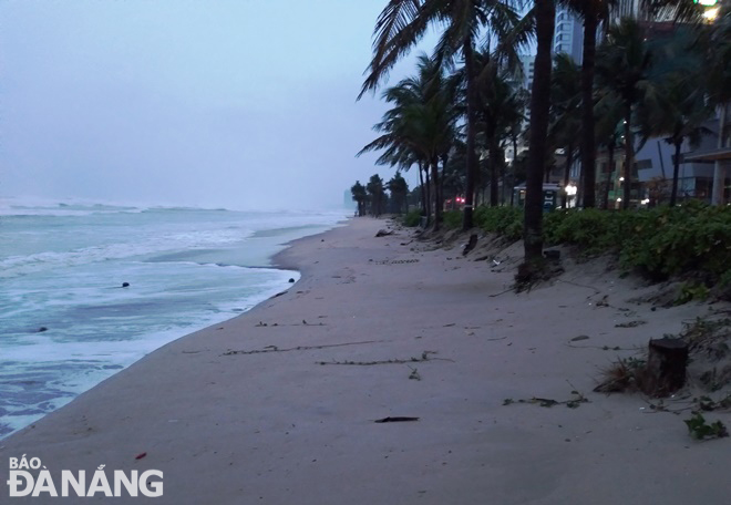 |
| Sea waves approaching coconut tree zone in the soft embankment to protect the Vo Nguyen Giap Coastal Route. Photo: HOANG HIEP |
Offshore areas stretching from Thua Thien- Hue to Phu Yen could see strong winds at levels 8 to 10, the area near the storm’s centre will witness gradually increasing high winds at levels 11 to 12, the gusts as high as level 14, and experience rough seas with waves as high as 6-8m.
The coastal areas from Thua Thien Hue to Phu Yen (including Ly Son Island) will see gradually increasing high winds at levels 7 to 8. The area near the storm’s centre could witness high winds at levels 9 to 11, and the gusts as high as level 13, as well as experience rough seas with waves as high as 2-5m.
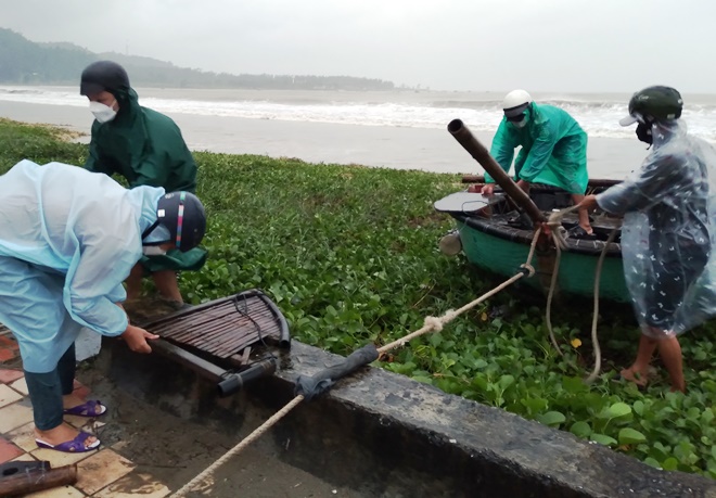 |
| Fishermen are pulling their basket boat ashore along the Hoang Sa Coastal Route as sea waves have penetrated deep into the shore due to the impact of storm Rai. Photo: HOANG HIEP |
Reporting by HOANG HIEP – translating by H.L