Waves batter coast as high winds and heavy rain from storm Rai hit Da Nang
The Mid-Central Region Centre for Hydro-meteorological Forecasting is urging people to stay away from Da Nang coasts and rivers as high winds and heavy rain brought by storm Rai hit the city.
Da Nang’s coastal areas could experience rough seas with waves as high as 4-6m, regional forecasters say.
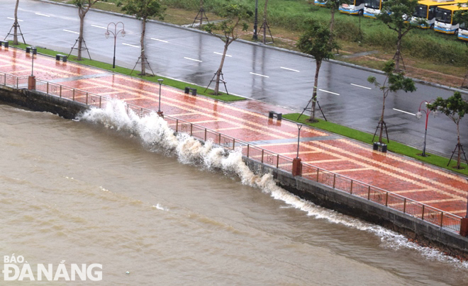 |
| Waves crashing on the embankment on Nhu Nguyet street, Hai Chau District during more strong winds on Sunday. Photo: HOANG HIEP |
In its latest weather bulletin, the Mid-Central Region Centre for Hydro-meteorological Forecasting said that at 10:00 am on Sunday, December 19, storm Rai’s centre was about 210km off the coast of the region from Binh Dinh to Phu Yen, packing maximum sustained winds at 150-185km per hour, and the gusts reaching level 17 or higher.
The radius of strong winds at level 6 and the gusts as high as level 8 is about 200km from the storm’s center.
The storm will continue to move toward the northwest over the next 24 hours, and then change its direction toward the north at 15-20km per hour.
At 10:00 am on Monday, December 20, the storm's center will sit over the waters off northwest coast of the Hoang Sa Islands with maximum sustained winds at levels 12 to 13, and the gusts as high as level 15.
Today into tomorrow, December 20, light to moderate rainfall is predicted for Da Nang, and heavy rain is likely to occur in some places. The total rainfall amount will be 50-100mm in common, with more than 150mm for some places.
Forecasters have also issued warnings of flash floods and landslides for mountainous areas, and localized flooding alerts are in place in low-lying areas and riverside areas.
Da Nang Steering Committee for Natural Disaster Prevention and Control is urging authorities in the coastal areas to take proactive and necessary mitigation measures in response to high tides and strong waves with overtopping possible caused by high winds from storm Rai.
The flood alert urges people to be careful and areas most at risk are beaches, promenades, coastal footpaths and roads as large waves and sea spray could be dangerous.
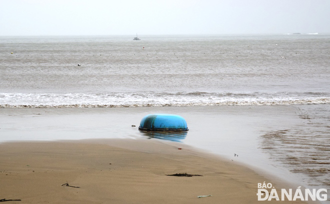 |
| A basket boat washed up on the Bai Ngang Beach in Tho Quang Ward, Son Tra District. Photo: HOANG HIEP |
The heed must be paid on assisting local residents to prepare for severe weather in an attempt to keep them safe and protect their properties. In addition, all necessary measures are needed to move people living in low-lying areas, along rivers and streams and areas at high risk of flash floods and landslides to safe places with proper precautions against COVID-19 in place.
Reporting by HOANG HIEP – translating by H.L