Nalgae forecast to downgrade to depression over next 2-3 days, no threat to Viet Nam's land
According to the 4:00 a.m. update from Viet Nam’s National Centre for Hydro-Meteorological Forecasting (NCHMF), tropical storm Nalgae was centred near latitude 18.7 degrees North, longitude 116.2 degrees East, about 570km northeast of the Hoang Sa Islands, packaging maximum sustained winds of level 11, and the gusts as high as level level 13.
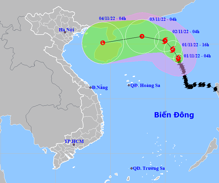 |
| The latest forecast track of tropical storm Nalgae. (Source: NCHMF). |
Additional intensification is forecast over the next 12 hours as the cyclone cuts across the East Sea, and gradual weakening is expected at 4:00 p.m. on Tuesday, according to NCHMF.
Nalgae is forecast to weaken to a tropical depression over the next 2-3 days, and is expected to be a remnant low afterwards, the national weather service says.
The storm could break up entirely over the western part of the North East Sea, forecasters say.
The storm is currently not a threat to Viet Nam’s land, forecasters said.
A warning for strong winds reaching levels at 6 to 7, gustiness of levels 8 to 9, and rough sea under the influence of the storm is issued to the western part of North East Sea (including the waters of the Hoang Sa Islands).
The open waters off the coast of the parts from Quang Tri to Ninh Thuan, including Da Nang, will see strong winds reaching level 6, sometimes level 7, and the gusts as high as levels 8 to 9 with rough sea and waves as high as 3m-5m on Tuesday, November 1. The winds will gradually weaken starting from Tuesday night.
Strong winds of level 5, sometimes level 6, gustiness of levels at 7 to 8, with rough sea and waves as high as 2m-4m are in forecast for the open waters off the Quang Tri - Ninh Thuan Coast on Wednesday.
National forecasters also issue a warning for strong winds and big waves to all vessels operating at the warning areas.
The combined effects of high waves and tides will increase the risk of coastal erosion in affected areas.
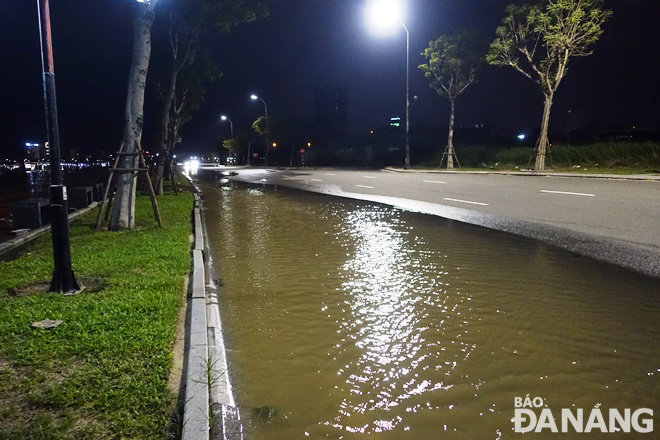 |
| During Monday night and early Tuesday morning, high tides and waves brought by tropical storm Nalgae and the northeast monsoon caused the Han River Estuary to overflow, sending a large amount to flood a part of riverside Nhu Nguyet Street. Photo: HOANG HIEP |
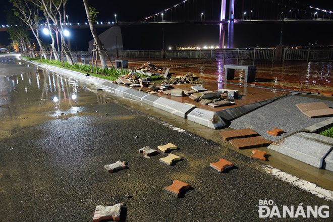 |
| High waves peeled off sidewalk tiles on riverside Nhu Nguyet Street and pushed them down on the road surface. Photo: HOANG HIEP |
Reporting by HOANG HIEP – Translating by H.L