Mid-central region remains on 'dangerous' weather alert with fooding and landslide warnings as rain continues to lash
Soil water content in the parts from Thua Thien- Hue to Khanh Hoa, including Da Nang, and Central Highlands is now near saturation (90-98%), Viet Nam’s National Center for Hydro-meteorological Forecasting reports.
The water level in rivers in the parts from Quang Nam to Khanh Hoa is fluctuating, while that in the downstream of Thu Bon River in Quang Nam Province is rising.
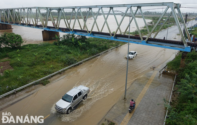 |
| The Yen River has overflowed its banks, sending a large amount of water to flood some sections of low-lying Thang Long Street. Photo: HOANG HIEP |
As per the national weather service, moderate to heavy rainfall with isolated very heavy falls and thunderstorms are very likely over the parts from Thua Thien-Hue to Quang Ngai, including Da Nang, from Saturday night through Sunday. The total rainfall amount will be 30mm to 50mm in common in these areas while more than 70mm of rain could fall in some places. As much as 15mm-30mm of rain could fall over the parts from Binh Dinh to Binh Thuan and the coastal areas of the Southwest region, and even more than 50mm at isolated locations.
From Sunday night into Tuesday, December 6, moderate to heavy rainfall is expected for the parts from Ha Tinh to Quang Ngai, including Da Nang, and isolated parts could even receive a heavy spell under the influence of the combined effects of the intensified cold air and upper level easterly winds. National forecasters indicate heavy rainfall of 100 mm to 200mm in these areas, and even in excess of 200mm at isolated places.
Flood warnings are in place for rivers in the parts from Quang Nam to Khanh Hoa, until Monday, December 5 as these rivers could face flood risk with floodwater expected to peak from 4 - 4m at their upstream areas and 1 - 2m at their downstream areas.
The water level in downstream areas of rivers in Quang Nam and Quang Ngai is likely to reach its peak to reach alarm levels 1 to 2 while that in rivers in the parts from Binh Dinh to Khanh Hoa are expected to reach alarm level 1 or above.
National forecasters have also issued warnings of flash floods and landslides for mountainous areas, and localized flooding alerts are in place in low-lying, riverside and urban areas in the parts from Thua Thien- Hue to Khanh Hoa, including Da Nang.
Below are some pictures of flooding in Da Nang on Saturday afternoon
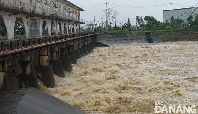 |
| Floodwater is flowing through the An Trach Dam to the downstream of the Yen River. |
 |
| A lot of garbage is trapped at the An Trach Dam which obstructs flood drainage. |
 |
| A road section and a low-lying agricultural land between Hoa Tien Commune, Hoa Vang District and Dien Tien Commune, Dien Ban Town, Quang Nam Province is flooded. |
Reporting by HOANG HIEP – Translating by H.L