Rain and flood maps added to Danang Smart City app
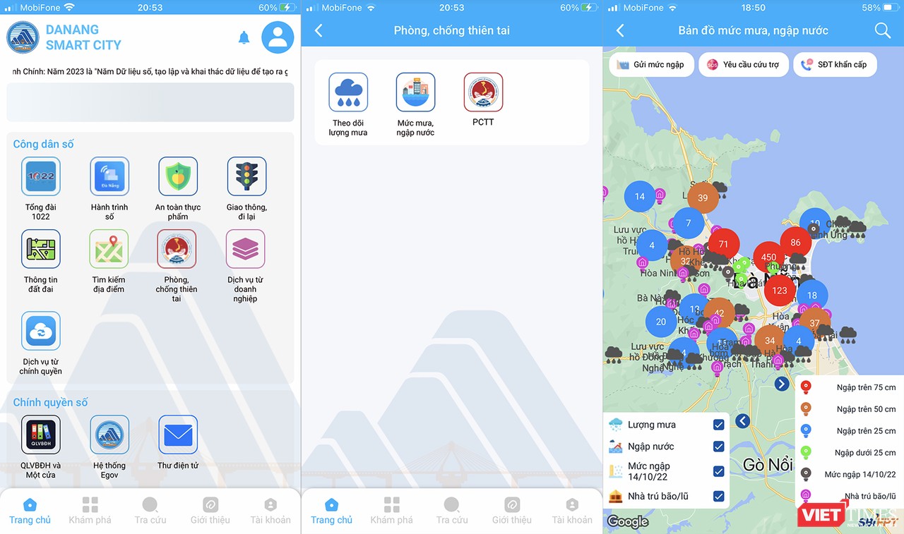
The Da Nang Department of Information and Communications has just integrated a map system to monitor rain and flooding in the city onto the Danang Smart City app to serve users.
 |
| Illustrative image. (Photo: DNO) |
With this integration, the system will publicise weather information, announcements and warnings, and ways to respond to natural disasters to the communities via the mobile app.
The provided content is displayed through specific folders, from monitoring rainfall in 31 local areas and comparing it with historical peak rainfall on October 14, 2022 on both maps and charts.
It also monitors flood levels at locations and main roads in the city and view information on peak flooding levels at 279 locations with specific coordinates.
The application also allows the user to search information on 1,067 storm and flood shelters throughout the city, along with specific addresses, accommodation capacity and contact numbers.
In particular, the system allows users to send information about the current flood level as well as related information when there is heavy rain to the system in order to publicise it to others.
They also can send a request to the competent authorities for support during rain and flood.
Reporting by M.Q - Translating by A.THU