Tropical depression expected to hit the Da Nang -Quang Nam Coast early Tuesday afternoon, bringing heavy rainfall to mid-central region until Wednesday
Meteorologists at the Mid-Central Region Centre for Hydro-meteorological Forecasting are tracking a new tropical depression intensified from the low pressure area (LPA) in the East Sea that was responsible for rain during Sunday and Monday morning in Da Nang, with very heavy rainfall at isolated locations.
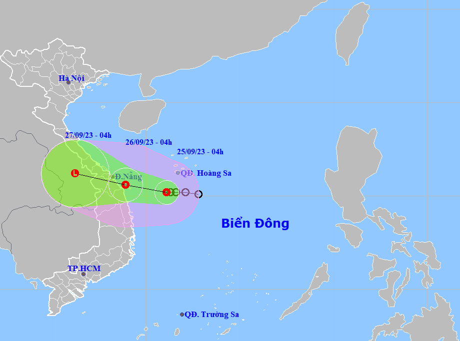 |
| The projected tropical depression path and map (Source: Viet Nam’s National Centre for Hydro-Meteorological Forecasting) |
Forecast models indicate that at 7:00am on Monday, September 25, the centre of the depression was spotted near latitude 15.2 North, longitude 110.6 East, about 300km east - southeast of the Da Nang Coast, packaging sustained winds reaching level 6, and the gusts as high as level 8.
Over the next 24 hours, the depression will move toward the west in the East Sea at 10-15 km per hour.
At 1:00pm on Monday, the depression's centre was located over the central Vietnamese Sea nearly 170km from the coast of Quang Ngai, and about 230km from the coast of Da Nang, with maximum sustained winds reaching levels at 6 to 7, and the gusts as high as level 9.
At 4:00 a.m. on Tuesday, the depression will be centred near latitude 15.6 North, longitude 108.9 East, sit over the open waters off the Da Nang - Quang Ngai coast, packaging maximum sustained winds reaching levels at 6 to 7, and the gusts as high as level 9.
Regional forecasters have issued a weather warning for strong winds and high waves to all vessels operating in the potentially dangerous area which is located near latitude 13-17.5 North, and longitude 113 East in the next 24 hours.
On the forecast track, the system is expected to make landfall early Tuesday afternoon, September 26, over the parts from Da Nang to Quang Nam, before weakening and downgrading to a remnant low.
The depression will continue to move towards west-northwest at 10-15km per hour, and then gradually weaken into a remnant low after making landfall over the parts from Da Nang to Quang Nam early Tuesday afternoon.
At 1:00pm on Tuesday, the depression will sit over the Da Nang – Quang Nam mainland, with the maximum sustained winds reaching levels at 6, and gusts at level 8.
At 4:00am on Wednesday, the depression will be centred near latitude 16.2 North, and longitude 106.2 East. The depression will be then downgraded to a remnant area of low pressure over southern Laos.
The depression is expected to bring heavy rainfall to the Mid-Central Region, including Da Nang, from Monday into Wednesday, September 27.
Heavy to extremely heavy rainfall is likely over the region with the total rainfall amount expected to reach 100mm to 300mm in common, and even over 350mm possible in some places.
Monday evening into Tuesday morning, the coastal areas from Quang Tri to Quang Nam, including Da Nang, could see strong winds at level 6, and gustiness of level 8 while farther inland could see gusty winds at levels 6 to 7.
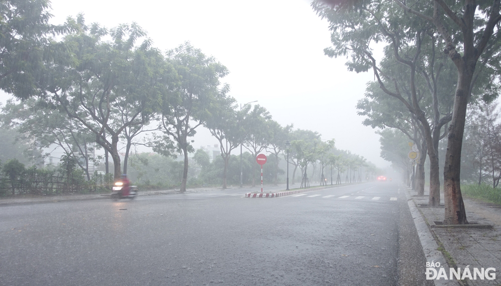 |
| Da Nang experienced heavy to very heavy rainfall on Tuesday morning. Photo: HOANG HIEP |
As per the regional weather service, moderate to heavy rainfall and thunderstorm chance with isolated very heavy falls are very likely over the Mid-central region, including Da Nang, till Wednesday, September 27.
Forecasters have also issued warnings of flash floods and landslides for mountainous areas, and localized flooding alerts are in place in low-lying and riverside areas over these areas. Therefore, mitigation measures are needed to cope with localised heavy rain which could trigger flooding in low-lying and riverside areas in the coming days.
The Da Nang Steering Committee for Disaster Response and Search and Rescue is urging authorities at local level and relevant units to take appropriate precautionary measures to cope with floods, flash floods, landslides brought by heavy downpours due to the influence of the tropical depression, as well as and minimise losses owing to heavy rain. The focus should be attached to ensuring the safety of the reservoirs, especially Hoa Trung and Dong Nghe, releasing the surplus water and protecting the dams, desilting canals, and facilitating the recharge of ground water besides avert damage due to floods.
The Da Nang Border Guard Command is asked to work with Da Nang Coastal Information Station to keep a close watch on severe weather development, and keep owners of vessels operating at sea timely informed about severe weather conditions in order to help them take the initiative to avoid dangerous areas or seek safe shelters during the bad weather. Special attention must be given to making the resources available in order to organize timely rescue of any person in distress at sea and provide timely support for those who need it during severe weather.
All necessary measures are needed to move people living in low-lying areas, along rivers and streams and areas at high risk of flash floods and landslides to safe places. High priority should be given to evacuating people from riverside properties along Yen, Tuy Loan, and Cu De rivers in communes of Hoa Tien, Hoa Khuong, Hoa Bac, Hoa Lien, Hoa Phu, Hoa Phong, and Hoa Son and moutainous areas in Hoa Vang District, Son Tra Peninsula and other high risk areas for flash floods and landslides in an effort to protect the safety of local people during bad weather.
Heed must be paid to deploying personnel to deeply flooded streets to set up vehicle barriers to stop driving through deep water in order to ensure the safety of road users. Importance is attached to resolutely banning people from travelling or fishing on rivers, low-lying areas, flooded areas, underground passages, flooded bridges, forests, mountains and landslide prone areas.
Special attention must be paid to taking proactive measures to immediately cut off power supply in deeply flooded areas, reinforce electric concrete poles to prevent falling in inclement weather conditions, ensure power supply for flood control pumping stations, and restore power as quickly and as safely as possible to affected areas.
Importance must be attached to keeping a close watch on severe weather development, and keeping local residents timely informed about severe weather conditions in order to help them protect their property from heavy rains and flooding. In addition, focus must be paid to assisting local residents to prepare for heavy rains in an attempt to reduce the risk of possible damages.
Reporting by HOANG HIEP – Translating by H.L