Flooding rain set to keep lashing Central Viet Nam, but heavy rain alert for Da Nang lowered to level 3
Viet Nam’s National Centre for Hydro-Meteorological Forecasting (NCHMF) has provided an update on the movements of the new low pressure system.
In its latest weather bulletin on Monday morning, the national weather service stated that a trough of low pressure is associated with a low pressure system which was located near latitude 13.7-14.6 North, longitude 111.4-112.4 East.
Over the next 24 hours, the system will continue to gain strength and is likely to concentrate into a well-marked low-pressure or even a tropical depression while it moves gradually west-northwestward over the East Sea.
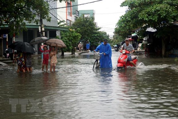 |
| Heavy rain caused flash flooding and water accumulation on some roads in Tam Ky City, Quang Nam Province. (Photo: VNA) |
Due to the influence of the low pressure system which is likely to become a tropical depression, showers and strong thunderstorms will be possible in the middle and northern and southern parts of the East Sea (including waters of the Truong Sa and Hoang Sa Islands), the open waters off the Quang Tri - Quang Ngai coast and the Binh Thuan - Ca Mau coast during daytime and night of Monday.
The Northern part of the East Sea and the Gulf of Tonkin could see strong northeast winds at levels 5 to 6, gustiness of levels 7 to 8 with rough seas.
Waves as high as 2-4m and 1.5-3m are expected to assail the northern part of the East Sea and the Gulf of Tonkin, respectively.
Warning for tornadoes and high winds has been issued for all vessels operating in the above-mentioned areas.
Mariners are advised to take precautionary measures when venturing out to sea and, if possible, avoid navigating in these conditions.
Heading into Tuesday night, the parts from Southern Ha Tinh to Binh Dinh, including Da Nang, according to the weather warning issued by NCHMF, will witness moderate to heavy rain ranging from 50mm to 100mm, and even over 150mm possible in some places.
During the forecast period, Quang Binh and Quang Tri will witness intense rainfall on Tuesday night while Thien Thien -Hue, Da Nang, Quang Nam are being warned to brace for heavy to extremely heavy falls with rainfalls of 150-350mm in common, and even more than 500mm at isolated locations.
The national weather service predicts an accumulated total of 50-100mm of rain for the parts from Southern Nghe An to Quang Ngai, including Da Nang, on Wednesday while over 150mm of rain could fall in some places of these areas.
The national forecasters have lowered alert of heavy rain, tornadoes, and lightning to level 3 from level 4 for Thua Thien-Hue, Da Nang, and Quang Nam while alert level 1 has been issued to Southern Ha Tinh, Quang Binh, Quang Tri, Quang Ngai, and Binh Dinh.
Forecasters have issued warnings of flash floods and landslides for mountainous areas in the affected areas, and localized flooding alerts are in place in low-lying and urban areas. The advisory urges residents to ‘be aware’ of inclement weather. Residents in affected areas are advised to get ready for such weather conditions in an attempt to reduce the risk of possible damages.
Reporting by TTXVN/Vietnam+ - Translating by H.L