Strengthening LPA expected to become tropical depression, bringing more rain, flood risk for Da Nang
A tropical depression could form over the next 24 hours in the East Sea, according to the Mid-Central Region Centre for Hydro-meteorological Forecasting.
Forecasters are watching a low pressure area (LPA) in the East Sea, and the system is getting stronger as it moves over the East Sea. The system is expected to intensify and strengthen into a tropical depression, according to regional forecasters.
The system has a high chance of developing into a tropical depression as it moves west-nothwestward over the East Sea during the next 24 hours.
Forecast models indicate on Monday morning, the LPA was spotted at near latitude 13.5-14.5 North, longitude 111.5-112.5 East.
Environmental conditions are forecast to be conducive for development while LPA move slowly west-northwestward in the East Sea, and the system is expected to to develop into a tropical depression over the next 24 hours.
As per the regional weather service, moderate to heavy rain with isolated extremely heavy falls and thunderstorm chance is forecast to continue lashing the city through Wednesday, October 18. During the forecast period, rain amounts are predicted to generally average between 100mm and 300mm with more than 350mm possible in some places.
Thunderstorms can produce tornadoes, lightning, hail and strong winds in the city, regional forecasters have warned.
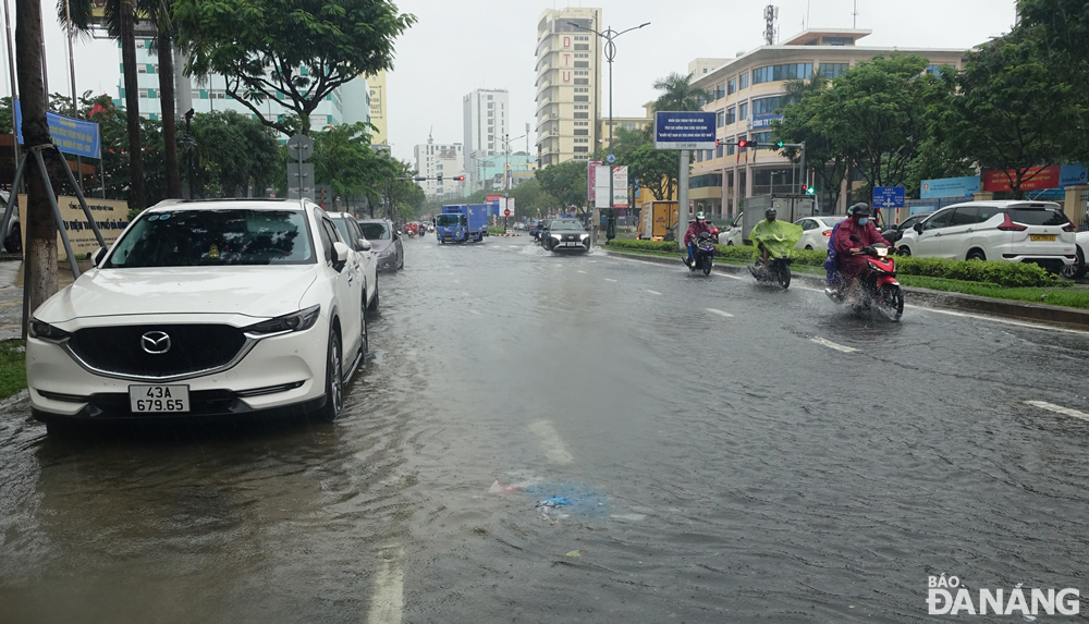 |
| A partially flooded Nguyen Van Linh Street was seen in Da Nang on Monday at noon. Photo: HOANG HIEP |
The regional weather service also issues flood warnings for Vu Gia River and other rivers in Da Nang as the Vu Gia River could face flood risk with floodwater expected to peak from 3m - 6m at its upstream areas and 1 - 2m at its downstream areas.
The water level in the Vu Gia River is likely to reach its peak to reach alarm levels 1 to 2 and above while that in other rivers in the city will reach alarm levels 1 to 2.
The Da Nang Steering Committee for Disaster Response and Search and Rescue is urging authorities at local level and relevant units to take appropriate precautionary measures to cope with floods, flash floods, landslides brought by heavy downpours, as well as minimize losses owing to heavy rain.
The Da Nang Border Guard Command is asked to work with Da Nang Coastal Information Station to keep a close watch on severe weather development, and keep owners of vessels operating at sea timely informed about severe weather conditions in order to help them take the initiative to avoid dangerous areas or seek safe shelters during the bad weather. Special attention must be paid to making the resources available in order to organize timely rescue of any person in distress at sea and provide timely support for those who need it during severe weather.
Authorities at local level are closely monitoring severe weather development to take mitigation measures in response to severe weather events.
Heed must be paid to deploying personnel to deeply flooded streets to set up vehicle barriers to stop driving through deep water in order to ensure the safety of road users. Importance is attached to resolutely banning people from travelling or fishing on rivers, low-lying areas, flooded areas, underground passages, flooded bridges, forests, mountains and landslide prone areas.
In addition, all necessary measures are needed to move people living in low-lying areas, along rivers and streams and areas at high risk of flash floods and landslides to safe places. Importance must be attached to making the resources available in order to drain rainwater from agricultural fields, low-lying areas, urban areas, most densely populated areas, industrial zones and other areas most at-risk of flooding in an effort to reduce costly damage to crops and property.
Reporting by HOANG HIEP – Translating by H.L