Plans to build Da Nang into a large, smart eco-urban area
The Da Nang master plan for the 2021-2030 period with a vision to 2050 has concretised the city’s aspiration to rise commensurate with its potential, strengths, role and position, including the orientation and vision of becoming a large, ecological, smart, identity-based city.
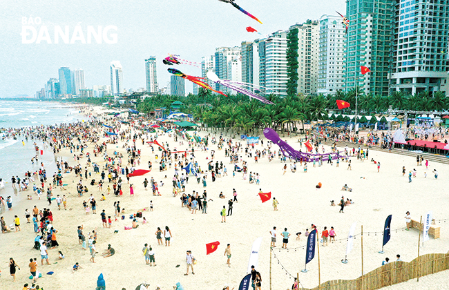 |
| A beach in Da Nang crowded with people |
Soon to become nucleus of Central region's heritage zone
After more than 25 years of construction and development, Da Nang has changed a lot and positively in terms of good infrastructure, highly appreciated living and working environment, the good level of information technology application, all serving as a premise for building a smart city.
In 2023, Da Nang’s urbanisation rate was 87.3%, 2 times higher than the national average (42% by 2022). The technical infrastructure of airports, seaports, accommodation facilities, and urban transportation systems allows Da Nang to take on the role of a tourist reception and distribution centre.
The city’s commercial infrastructure is comprehensively invested, initially taking on the role of a wholesale distribution centre for the Central Viet Nam and Central Highlands regions.
The city has advantages in terms of cultural, medical and educational facilities, and relatively good infrastructure compared to the general level of the country.
Good indicators about economic scale, level of commercial attraction, and the development of the business force show that the city is now and in the future an important economic hub of the Central Viet Nam and Central Highlands regions.
The abovementioned things are gradually affirming that Da Nang is a large urban area in the country with an important traffic hub, the leading socio-economic centre, the driving force for regional development, and a leader in international integration.
Dr. Architect Truong Van Quang, Deputy General Secretary of the Viet Nam Urban Development Planning Association, assessed Da Nang as an urban area with a beautiful location along the banks of the Han River and the East Sea.
The Mother Nature has generously endowed Da Nang with many beautiful and famous landscapes such as the Hai Van Pass -'World's most marvelous wonder', the Marble Mountains, and the Son Tra Peninsula.
Furthermore, Da Nang is also located between three world cultural heritages, namely Hue ancient capital, Hoi An ancient town and My Son sanctuary.
It is positioned right on one of the international sea and air routes, so it has a particularly favourable location for rapid and sustainable development.
With the idea of taking the Da Nang Bay and Han River as the main layout in urban space planning, Da Nang is expanding its space to the west, northwest, southwest, south and southeast.
In the near future, the Da Nang urban area will be formed, including the Chan May (Lang Co, Thua Thien Hue Province) - Da Nang - Dien Ban - Hoi An - Nam Hoi An (Quang Nam Province) acting as the nucleus of the central key economic region.
Dr. Architect Truong Van Quang also shared that according to the opinion of many planning experts, the Da Nang urban area will soon become the nucleus of the Central region's heritage zone.
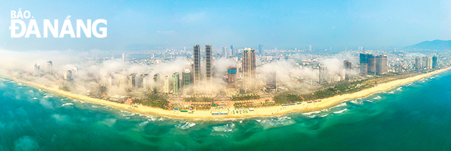 |
| A panoramic view of Da Nang |
3 typical urban areas and a ecological zone
According to the urban space development orientation under the Da Nang Master Plan for the 2021 - 2030 period, with a vision to 2050, the whole city will have 3 typical urban areas and an ecological zone with 12 subdivisions.
In particular, the urban area along the water surface along the east coast of the city, the Da Nang Bay, and local rivers will have 3 subdivisions: a 6,644ha subdivision along the Han River and the east bank, a 1,530ha one along the Da Nang Bay, and a 1,285ha one along the Lien Chieu Seaport.
The green core urban area is located in the middle of the city will have a total of four subdivisions: high technology (5,585ha), green core centre (4,775ha), innovation (3,903ha) and airport (1,327ha).
The hillside urban area is characterised by large, open spaces along the slopes of the western hills and mountains with 3 subdivisions: hillside urban area (2,729ha), high-tech agriculture (2,986ha), development reserve (5,858ha).
The ecological region includes the forest, mountains and hills area on the western side of the city (from the Bach Ma - Hai Van mountain range through Hoa Bac and Hoa Lien communes, connecting Ba Na mountain range through Hoa Ninh, Hoa Phu and Hoa Khuong communes); the Son Tra Peninsula area and Hoang Sa District; and the area of rivers and lakes along with the long coastline in the ecoregion.
The ecological zone will have 2 subdivisions: the western ecological subdivision (57,692ha) and the eastern ecological subdivision (including Hoang Sa District and Son Tra Peninsula with an area of 4,232ha).
Urban space is also shaped for development in the direction of adjusting the monocentric urban structure (Thanh Khe and Hai Chau districts) into multi-polar development; and developing the entire city of Da Nang into a major tourist destination.
Besides, the city strives to develop Hoa Vang District to meet the criteria of a type 4 urban area, 80% of communes are eligible to become wards and eligible to establish towns as soon as possible.
By 2030, the urbanisation area will focus on communes of Hoa Khuong, Hoa Phuoc, Hoa Chau, Hoa Tien, Hoa Phong, Hoa Nhon, Hoa Lien, Hoa Son and part of Hoa Ninh in Hoa Vang District; The district’s urbanisation rate is expected to reach over 90%.
Secretary of Hoa Vang District Party Committee To Van Hung said Hoa Vang will develop towards an ecological urban area and have its own identity in the near future.
Reporting by HOANG HIEP - Translating by M.DUNG, P.TRA