Tropical depression evolves into storm
A tropical depression strengthened into a storm on Sunday morning, having become the second hitting the East Viet Nam Sea since the beginning of this year.
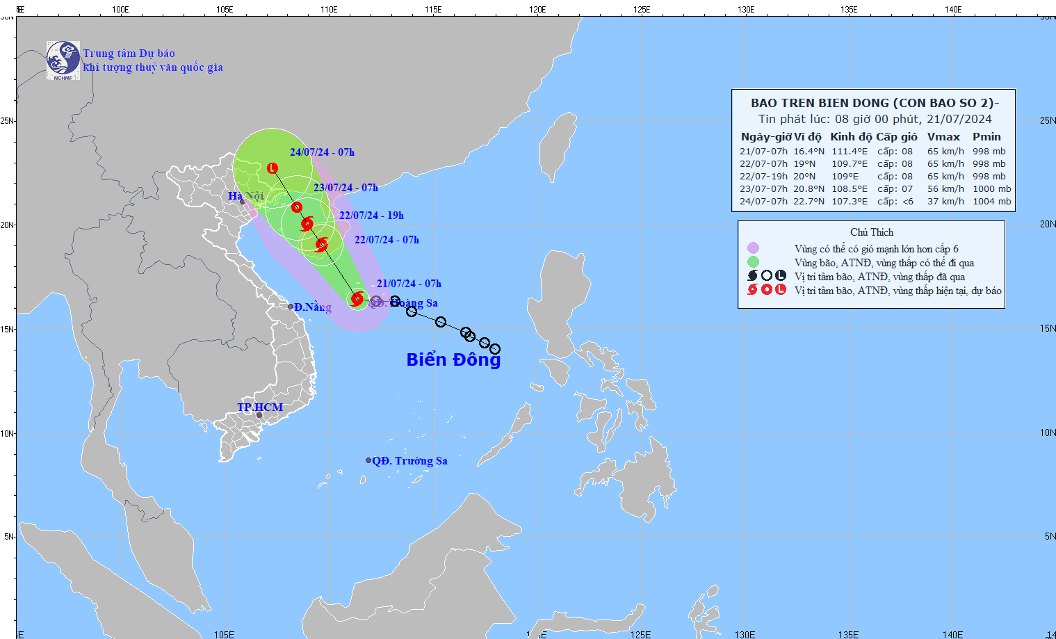 |
| Illustration of the trajectory of the storm in the East Sea. Photo courtesy of the National Center for Hydro-Meteorological Forecasting |
At 7:00 am this morning, the storm's eye was at around 16.4 degrees north latitude and 111.4 degrees east longitude in the waters of the Hoang Sa Archipelago. The strongest wind near its eye was level 8 (62-74km/h), gusting to level 10, according to the National Centre for Hydro-meteorological Forecasting (NCHMF).
The storm is forecast to move in the northwest direction at a speed of 10-15 km per hour in the next 24 hours.
At 7:00 am tomorrow, the storm's centre will be positioned on Hainan Island (China) with the strongest wind close to its eye reaching level 8, with gusts at level 10.
Under the influence of the storm, sea area western of the north and middle parts of the East Sea (including the Hoang Sa Archipelago), and the sea area eastern of Quang Tri to Quang Ngai provinces, experience strong winds of level 6-7, and medium rains.
The Da Nang Steering Committee for Natural Disaster Prevention, Search and Rescue and Civil Defence has urged the municipal Border Guard High Command and the municipal Coastal Information Station to keep all fishing boats operating at sea well informed of the position, direction and movement of the storms, hereby allowing them to take the initiative to avoid dangerous areas or seek safe shelters.
Relevant units and localities have been asked to closely monitor developments of the storm to proactively handle situations that may arise.
Reporting by HOANG HIEP - Translating by M.DUNG, P.TRA