Newly-formed tropical depression near East Sea forecast to develop into storm
According to the National Centre for Hydro-Meteorological Forecasting (NCHMF), a tropical depression recently formed in the sea area just east of the Philippines is forecast to head towards the East Sea soon. The depression is likely to develop into a storm making a landfall in some Vietnamese central coastal localities, and carrying heavy rains and rough seas.
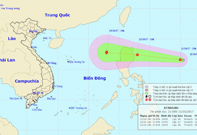 |
| The expected path of the depression (Photo: NCHMF) |
At 7.00 pm on 11 October, the depression was located at latitude 16°6’N and longitude 130°0’E, about 850km east of the Philippines’ Luzon Island, packing strong winds of 40 and 60 kph near its centre (level 6/7) and gusts of level 9.
Over the next 24 hours, the depression is expected to move in a west-northwest direction at a velocity of 25 to 30km an hour.
At 7.00pm today, 12 October, the depression’s position is predicted to be at latitude about 17°4’N and longitude 123°0’E in the sea area northeast of the Luzon Island, with maximum winds of 60 kph (level 7) and squalls of level 9.
Over the next 48 hours, the tropical depression is forecast to move westwards a speed of about 20km per hour, and is likely to develop into a storm.