Local adjustments to Da Nang's general planning
The Da Nang government issued Decision No. 2242/QD-UBND on October 16 for the approval of local adjustments to the city’s general planning by 2030 with a vision to 2045 on land use in the subdivision along the Han River and its eastern bank; the Lien Chieu Port and the Van Village.
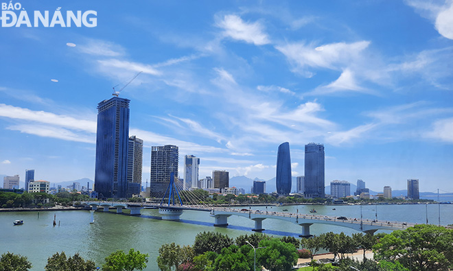 |
| The urban development area along the Han River. Photo: G.P |
Specifically, the study area for local adjustment has an area of about 6,644 ha in the subdivision along Da Nang's Han River and its eastern bank located in Hai Chau and Son Tra districts. Of which, the locally adjusted planning area is about 136 ha, accounting for about 0.14% of the mainland area according to Decision No. 359/QD-TTg dated March 15, 2021.
The local adjustment will focus on converting 15ha of the mixed-use land in the Thuan Phuoc Bay Urban Area into a limited-use green land.
Also, heed will be on reallocating the land designated for providing medical and urban public services, and , building a senior high school, including the western area of September 2 Street and the frontage area of Ngo Quyen Street.
In particular, the area in the west of September 2 Street will have the land for medical and urban public services, and senior high school, converted into existing residential unit land combined with commercial services and urban public - service land according to the actual status.
As for the area in front of Ngo Quyen Street, a residential unit combined with trade and services will be adjusted to senior high school land based on the current status of vacant land managed by the State.
With regard to the Lien Chieu Port and the Van Village, about 31,786 ha of the urban construction land will be adjusted by 2030, accounting for about 32.25% of the land area on mainland.
In particular, civil land will be about 14,093 ha, making up by about 44.34% of urban construction land. Of which, residential unit land will be about 9,595 ha (about 61.5 m2/person), including housing groups, service works - public areas, public trees, roads and parking lots for residential units.
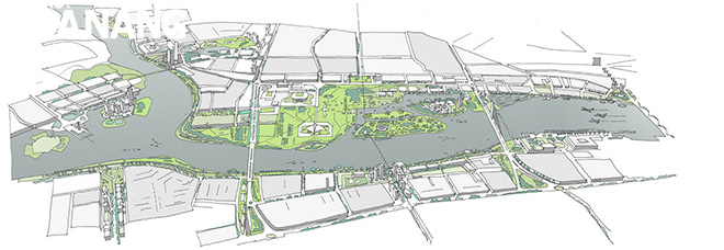 |
| Technical plan for urban planning along the Han River. Photo: G.P |
Green land for urban public use will be about 1,392 ha. Meanwhile, the mixed-use land of about 2,545 ha will be used for building houses, mixed-use buildings or a number of different purposes.
The about 17,693 ha non-civil land will feature 4,117 ha of industrial and high-tech land, 232ha of warehouse and logistics centre, 569had of research and training centre land, 43ha of agency land, 136ha of medical centres, 2,332ha of tourism land, 109ha of religious land, and 3,089ha of traffic land.
About 1,147ha will be designated for key technical infrastructure works, about 444ha for thematic green trees, about 931ha for a sports center, and about 1,464ha for specialised green space.
Relevant agencies are tasked to update and present the contents of local planning adjustments in documents on adjusting the city’s General Planning by 2030 with a vision towards 2045 in a bid to ensure compliance with regulations, and then send them to relevant units for storage and implementation.
Reporting by GIA PHUC - Translating by M.DUNG