Super Typhoon Goni expected to weaken as it enters East Sea
Super Typhoon Goni pounded the Philippines Sunday with authorities warning of "catastrophic" conditions in the region expected to take the hardest hit, where more than 300,000 have fled their homes.
 |
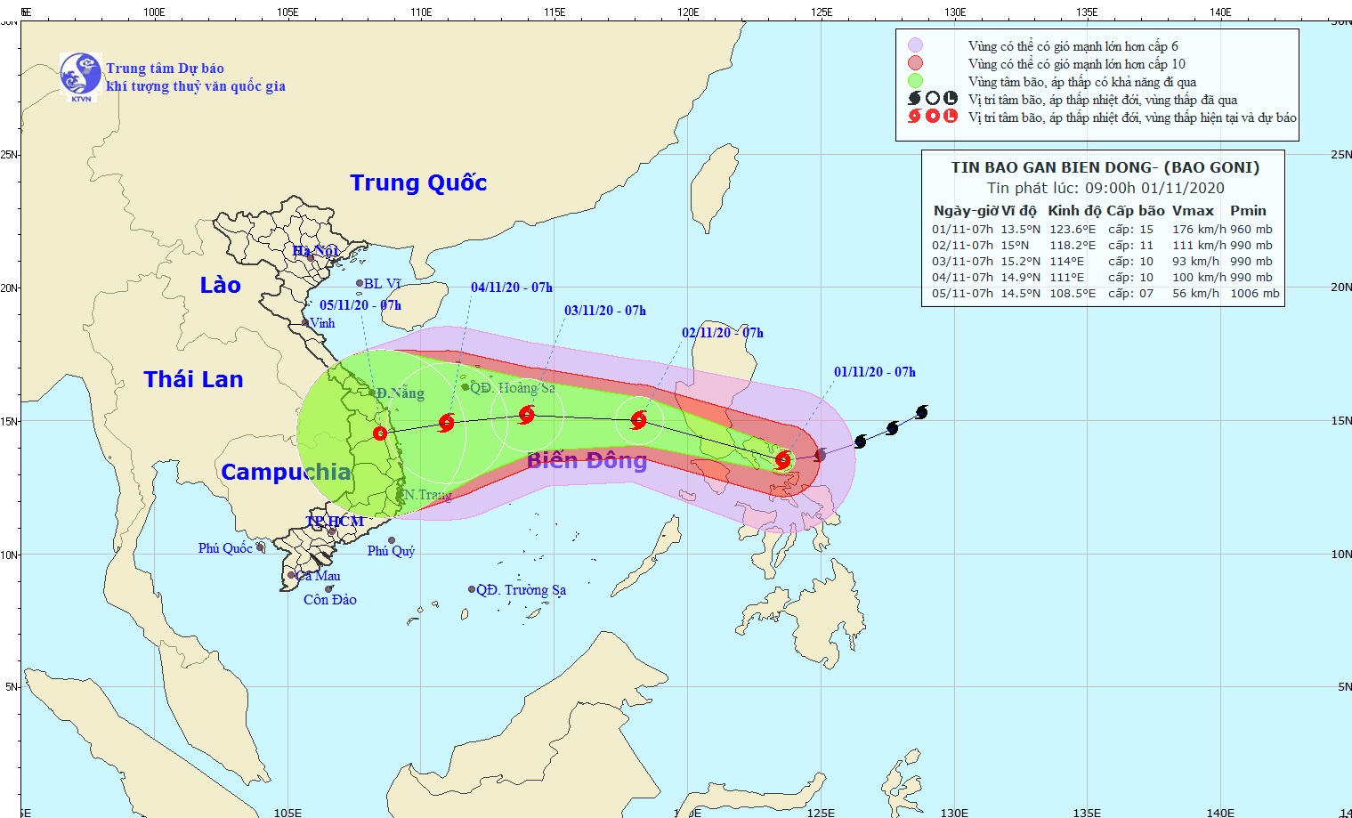
| Storm Goni tracking map (Photo: NCHFM) |
The strongest typhoon of the year so far made landfall on Catanduanes Island at 4:50 am (2050 GMT Saturday) with maximum sustained wind speeds of 225 kilometres per hour, Viet Nam's National Hydrology Meteorology Forecast Centre (NCHFM) said.
Goni, which intensified into a "super" typhoon as it neared the Philippines, comes a week after Typhoon Molave hit the same region of the natural disaster-prone archipelago.
Goni is among the strongest typhoons to hit the Philippines since Haiyan, which killed more than 6,300 people in 2013.
Goni is expected to weaken as it crosses southern Luzon and enters the East Sea late Sunday or early Monday as a typhoon, national weather forecasters said.
In the next 24 hours, Goni is racing the west-northwestward at 20-25kph.
At 7.00 am on 2 November, the centre of Goni will be located near latitude 15°0’N and longitude 118°2’E, about 660km east-southeast of the Hoang Sa Archipelago with maximum sustained winds near the centre falling a bit to level 11, with a gust of level 13.
Both Vietnamese and foreign weather forecasters say that Goni could be weaken into a tropical storm as it approaches the mid-central coast of Viet Nam due on 5 November.
The Da Nang Border Guard High Command and the municipal Coastal Information Station are urging fishermen and seafarers to keep up with the latest Goni watches and warnings with NCHFM in order to take the initiative to quickly return to port or seek safe shelter from the storm.
In addition, Da Nang fishing boats are not allowed to head out to sea, and relevant agencies will keep in close contact with boats at sea in order to handle any unexpected incidents.
By HOANG HIEP - Translated by M.D