Da Nang lightly shaken as a result of earthquake in Kon Tum Province
Residents in Da Nang felt light tremors at about 2:08pm on Tuesday.
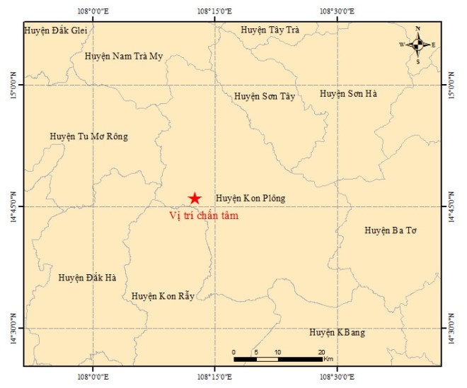 |
| The map shows the location of the epicenter (red star) of the first earthquake in Kon Plong District, Kon Tum Province, Viet Nam’s Central Highlands at 8:34 pm on April 15, 2022. Photo: The Institute of Geophysics |
The vibrations possibly resulted from a 4.7-magnitude earthquake at a depth of 8.2km hitting Kon Plong, a mountainous district of Kon Tum Province in Viet Nam’s Central Highlands, at latitude 17°768'N and longitude 108°209'E, according to the Institute of Geophysics under the Viet Nam Academy of Science and Technology. The earthquake poses a disaster risk of level 1
Another three shakes, with magnitudes at 3.6, 3.7 and to 2.5, took place at 2:11, 3:02 and 3:27 pm, respectively, with their epicenters being 8.1 kilometers underground.
These earthquakes did not pose any disaster risk, the center said, adding that it was continuing observing related developments.
Since the beginning of this year, Kon Tum Province has experienced many consecutive earthquakes that have been identified as provocative earthquakes.
The areas where the earthquakes have happened in Kon Tum are located on the Rao Quan - A Luoi fault system, which starts in Laos and stretches until the south-central province of Binh Dinh’s Quy Nhon City, said Cao Dinh Trieu, former deputy head of the Institute of Geophysics.
On this fault system, stimulant earthquakes have been recorded in some localities, especially in Quang Nam when hydroelectric reservoirs are filled with water.
Reporting by HOANG HIEP - Translating by M.DUNG