Warning for heavy rain bringing floods and landslides for Da Nang
Flood and landslide warnings are in place for low-lying and moutainous areas of Da Nang after parts of the city have been submerged by moderate to heavy rain since Friday morning, according to the Mid-central Region Centre for Hydro-Meteorological Forecasting.
Many streets were partly flooded after heavy rain had lashed the city this morning.
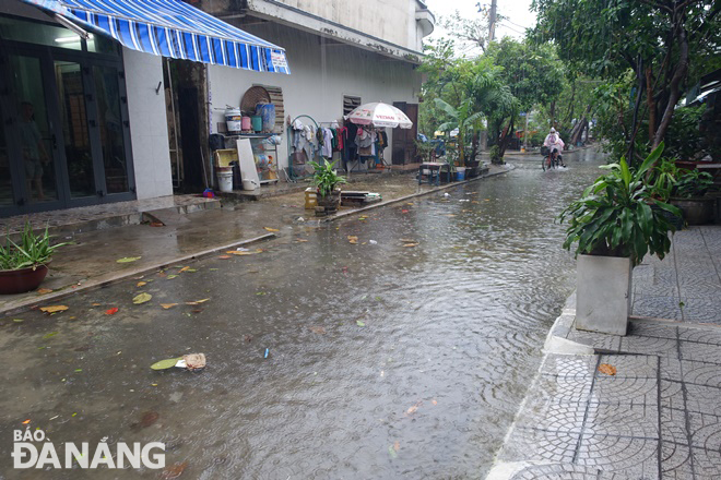 |
| Nai Thinh 3 Street in Son Tra District was partly flooded on Friday morning. Photo: HOANG HIEP |
Since 5:00 am on Friday, torrential rain has dumped in many parts of Da Nang, and Son Tra District has been hit by the heaviest downpours, leaving many streets under water, including Ton Quang Phiet, Nai Thinh 3. , Le Tan Trung, Le Van Luong.
Moderate to heavy rainfall was recorded in areas most prone to flash floods and landslides, especially in Hoa Bac, Hoa Phu, Hoa Ninh and Hoa Son communes, Hoa Vang District.
In order to cope with risks of flash floods on the Cu De River, Hoa Bac Commune People's Committee Chairman Thai Van Hoai Nam said that a warning for floods and flash floods brought by heavy rain has been issued to local residents to help them take precautions against extreme weather conditions to protect themselves and their properties during the bad weather.
Residents in such flood-prone villages as Loc My, An Dinh, and Nam Yen are asked to prepare for floods and possible isolation by stocking up on essential items including medication, food, and drinks. Communal level authorities in Hoa Vang District have made emergency response and evacuation plans for landslide prone areas, and residents in these high-risk areas will be moved to safe place following the order from the Hoa Vang District authorities. Importance is attached to resolutely banning people from travelling or fishing on rivers, low-lying areas, flooded areas, underground passages, flooded bridges, forests, mountains and landslide prone areas.
Heed is keeping a close watch on severe weather development, and keep local residents timely informed about severe weather conditions in order to help them protect their property from heavy rains and flooding. In addition, special attention is given to assisting local residents to prepare for heavy rains in an attempt to reduce the risk of possible damages.
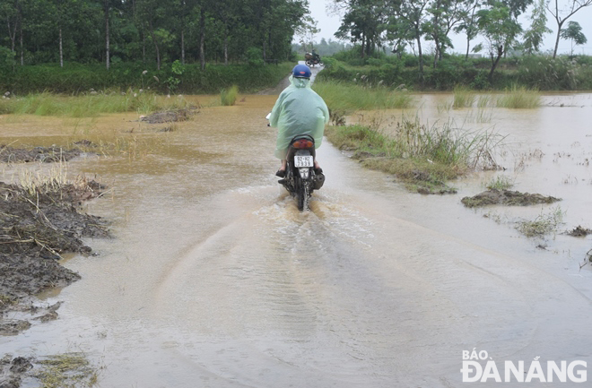 |
| The Yen River has overflowed its banks, sending a large amount of water to flood nearby low-lying roads. Photo: HOANG HIEP |
At 7:00 am on Friday, the water level at the Ai Nghia Hydrological Station on Vu Gia River in Dai Loc District, Quang Nam Province was 7.1m, 0.6m above alarm level 1. Water levels are slowly receding in Yen and Cam Le rivers as reservoirs of hydropower plants are discharging water into the downstream of the Vu Gia River while water levels in these rivers will rise again due to heavy rain.
Some low-lying riverside roads in Hoa Vang and Cam Le districts are still flooded.
Discharges from reservoirs of A Vuong, Song Bung 4 and Dak Mi 4 hydropower plants into the downstream of the Vu Gia River were 972m3/s in order to make sure that water levels are lowest at these reservoirs not later than 10:00am on Friday in an effort to cope with heavy rains which could trigger flooding in high-risk areas in line with the direction from the Da Nang Steering Committee for Natural Disaster Prevention, Search and Rescue and Civil Defence.
Currently, the three hydropower plants are ready to take action to help reduce flood risk in the downstream of the Vu Gia River.
A Vuong Hydropower Company Deputy General Director Ngo Xuan said that reservoirs of A Vuong Hydropower Plant are ready to receive more than 80 million m3 of floodwaters from the downstream of the Vu Gia River in a bid to reduce flood risk in this area. The amount of floodwaters flowing from the downstream of the Vu Gia River into A Vuong hydropower plant’s reservoirs was more than 52 million m3 from October 10 - 12.
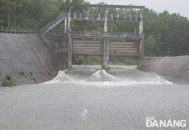 |
| The Dong Nghe Lake has burst its banks, sending a large amount of water to the downstream of the Vu Gia River due to heavy rain. Photo: HOANG HIEP |
According to the Da Nang Steering Committee for Natural Disaster Prevention, Search and Rescue and Civil Defence, on Friday morning, the water level in the Hoa Trung Reservoir was 0.1m higher than normal while that on the Dong Nghe Reservoir was 0.54m greater than the threshold discharge for flooding.
There is one fishing boat with 11 crew members operating at sea but its owner is keeping a close watch on severe weather development in order to take the initiative to avoid dangerous areas or seek a safe shelter during the bad weather in addition to maintaining regular contact with relevant agencies, local authorities and their families. A total of 1,229 fishing boats are anchored at the Tho Quang Fishing Wharf to prepare for severe weather.
The Da Nang Border Guard Command is asked to work with Da Nang Coastal Information Station to keep a close watch on severe weather development, and keep owners of vessels operating at sea timely informed about severe weather conditions in order to help them take the initiative to avoid dangerous areas or seek safe shelters during the bad weather. Special attention must be given to making the resources available in order to organize timely rescue of any person in distress at sea and provide timely support for those who need it during severe weather.
Authorities at local level are closely monitoring severe weather development to take mitigation measures in response to severe weather events.
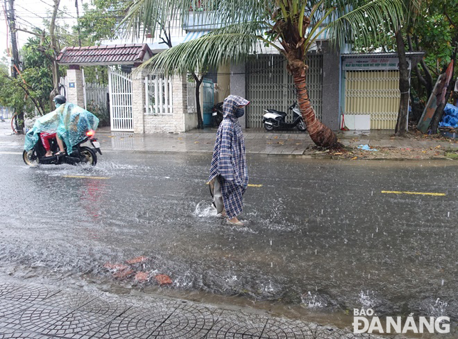 |
| Ton Quang Phiet Street in Son Tra District is partly flooded. Photo: HOANG HIEP |
The Mid-central Region Centre for Hydro-Meteorological Forecasting predicts moderate to heavy rain with localised very heavy rainfall and thunderstorms in Da Nang from Friday through Saturday, October 15.
The heavy rain in the city could see between 200mm and 400mm fall in Hoa Vang, Cam Le, Son Tra and Ngu Hanh districts, with up to more than 500mm possible in some places.
As much as 150mm-350mm of rain could fall in Lien Chieu, Hai Chau and Thanh Khe districts, and even more than 400 mm in some places.
Rainfall activity for Da Nang is likely to reduce from Saturday night into Sunday but moderate rainfall is expected for the city and isolated parts could even receive a heavy spell. The total rainfall amount will be 40mm-70mm in common in the city while more than 100mm of rain could fall in some places.
Regional forecasters have also issued warnings of flash floods and landslides for mountainous areas, and localized flooding alerts are in place in low-lying and riverside areas in Da Nang. Therefore, mitigation measures are needed to cope with localised heavy rain which could trigger flooding in low-lying areas and landslides in moutainous areas in the coming days.
Reporting by HOANG HIEP – translating by H.L