Mid-central region braces for cold and wet conditions
The Mid-Central Region Centre for Hydro-meteorological Forecasting has warned of a cold and wet weather forecast for the parts from from Quang Binh to Quang Ngai, including Da Nang, due to the combined influence of cold air and the upper-tropospheric easterly winds, from Monday until Friday, November 17.
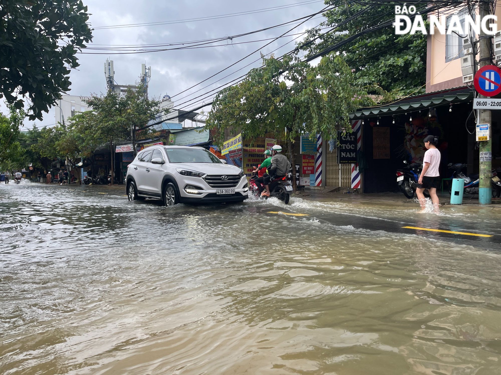 |
| Regional weather service predicts spells of heavy rain in Da Nang from Monday until Friday, November 17. |
Under these conditions, by the coastal areas they will see high winds at levels 4 to 5 and gustiness of levels 6 to 7, and farther inland you could find gradually increasing northeasterly wind at level 3.
As per the Regional Weather Service, the cold and wet weather will reach the mid-central region when a cold front makes landfall in the northern part of the region on Sunday night.
This is expected to bring widespread, heavy rain to the region during the forecast period. Moderate to heavy rain with localised very heavy downpours and thunderstorms will develop across the region, regional forecasters have said.
Thunderstorms can produce strong winds, lightning, hail and tornadoes, the regional weather forecasters have warned.
In particular, Quang Binh and Quang Tri provinces could receive 150mm-350mm of rain with over 400mm possible in some places. As much as 250mm-500mm of rain could fall over the parts from Thua Thien Hue to Quang Ngai, including Da Nang, and even more than 700mm at isolated locations.
The regional weather service is warning residents of heavy rain in Da Nang from Monday into Friday, November 17. The city is being warned to brace for widespread heavy rain, with rainfalls of 250-450mm, and even more than 600mm of rain possible in some places.
From Monday night, November 13, breezy northeasterly winds will bring in cooler air to mountainous areas in the northern part of the mid-central region as temperatures could plummet to lows of 18 to 20 degrees Celsius, and even below 18 degrees Celsius in high mountains.
The open waters off the Quang Binh – Quang Ngai Coast, including Da Nang, could see gradually increasing northeast wind at level 6, and the gusts reaching levels at 7 to 8, as well as experience rough seas with waves as high as 2-3.5m.
The regional forecasters have warned that persistent soaking rain would carry major risks of landslides and flash floods over the parts from Quang Binh to Quang Ngai, including Da Nang.
Forecasters have issued warnings of flash floods and landslides for mountainous areas, and localized flooding alerts are in place in low-lying and urban areas. Residents in the mid-central region, including Da Nang, are advised to monitor future forecasts and warnings to take all the steps to protect themselves and their property during heavy rains.
A flood warning has been also issued for the region as river levels could rise due to persistent torrential rains.
The Regional Weather Service has issued flood warnings for rivers in the parts from Quang Binh to Quang Ngai, including Da Nang, from Monday through Saturday, November 18 as these rivers could face flood risk. The water level in rivers in Quang Binh and Quang Tri provinces is likely to reach its peak to reach alarm levels 1 to 2 and above while that in rivers in the parts from Thua Thien- Hue to Quang Ngai, including Da Nang, is expected to reach alarm levels 2 to 3, and above.
Meanwhile, the water level in the Vu Gia River is likely to reach its peak to reach alarm below level 3 and above while that in Da Nang’s rivers is expected to reach alarm levels 1 to 2.
 |
| Staff at the Da Nang-based Intelligent Operation Centre (IOC) are closely monitoring severe weather development in the city in an effort to help authorties at local level and relevant units to make the resources available to conduct rescue operations in a timely manner, as well as provide timely support for those who need it during severe weather events. Photo: HOANG HIEP |
The Da Nang Steering Committee for Disaster Response and Search and Rescue is urging authorities at local level and relevant units to take appropriate precautionary measures to cope with floods, flash floods, landslides brought by heavy downpours, as well as minimize losses owing to heavy rain. The focus should be attached to ensuring the safety of the reservoirs, releasing the surplus water and protecting the dams, desilting canals, and facilitating the recharge of ground water besides avert damage due to floods.
Heed must be paid to deploying personnel to deeply flooded streets to set up vehicle barriers to stop driving through deep water in order to ensure the safety of road users. Importance is attached to resolutely banning people from travelling or fishing on rivers, low-lying areas, flooded areas, underground passages, flooded bridges, forests, mountains and landslide prone areas.
In addition, all necessary measures are needed to move people living in low-lying areas, along rivers and streams and areas at high risk of flash floods and landslides to safe places. Special attention must be given to making the resources available in order to drain rainwater from agricultural fields, low-lying areas, urban areas, most densely populated areas, industrial zones and other areas most at-risk of flooding in an effort to reduce costly damage to crops and property.
Besides, relevant units should provide guidance and advice for construction sites to prepare for severe weather.
Reporting by HOANG HIEP – Translating by H.L