Tropical depression develops into storm in East Sea, bringing heavy rain and strong winds to Da Nang
A tropical depression has strengthened into a storm on Tuesday morning after entering the East Sea, and this is the 4th storm to hit the country this year, Viet Nam's National Centre for Hydro-Meteorological Forecasting has said.
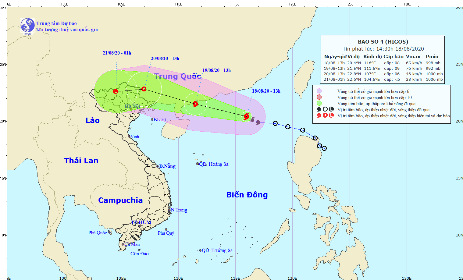 |
| The expected track of the storm (Source: The National Centre for Hydro-Meteorological Forecasting) |
At 1pm today, 18 August, the storm, internationally named Higos, was positioned at latitude 20°4'N and longitude 116°0'E, about 570 kilometers northeast of Viet Nam's Truong Sa (Spratly) Archipelago. It packs sustained wind speeds of up to 75kph at level 8, with strong gusts of up to 130kph at level 10 near its centre.
Over the next 24 hours, the tropical storm will move in the west- northwest direction with a speed of 20 km/ hour, and continue to pick up strength.
By 1.00pm tomorrow, 19 August, the storm’s centre will be at latitude 21°5'N and longitude 111°5'E, on the south coast of China’s Guangdong Province, with wind speeds increasing to 75-90kph and gusts at up to 120 kph.
It will continue moving in the west- northwest direction with a speed of 20 km/ hour in the next 24 to 48 hours, and will make landfall in the southern part of China’s Guangxi Province.
Due to the strong influence of the 4th storm, some Vietnamese northern localities are bracing for moderate to heavy downpours with the average rainfall of between 40 and 80mm per day, and even over 100mm in some of their parts.
Meanwhile, scattered moderate to heavy showers are expected to batter central regional localities from Da Nang to Binh Thuan, especially at night, with the potential for whirlwinds and lightning.
By HOANG HIEP, TTDBKTTVQG - Translated by M.D