Goni could weaken into depression as it strikes land in region from Quang Ngai to Khanh Hoa
Despite the prediction that Da Nang would not be directly impacted by storm Goni, Da Nang government is taking a series of proactive responses to the threat of flooding and landslides triggered by the upcoming storm.
 |
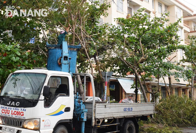
| Pruning the branches of trees on streets in Son Tra District in preparation for storm Goni |
 |
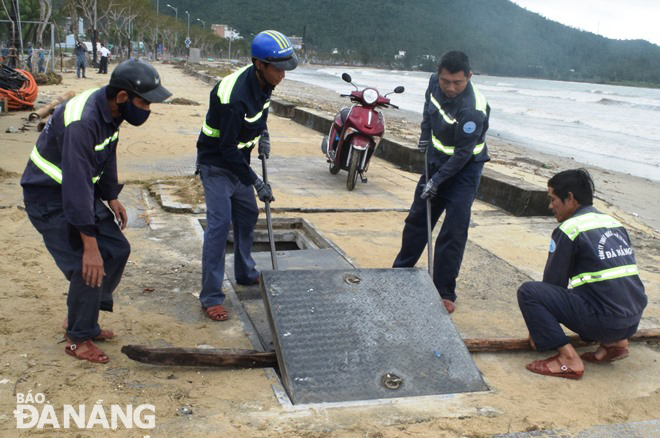
| Workers of Da Nang Sewerage and Wastewater Treatment Company conducting maintenance on coastal outlets to prevent flooding. |
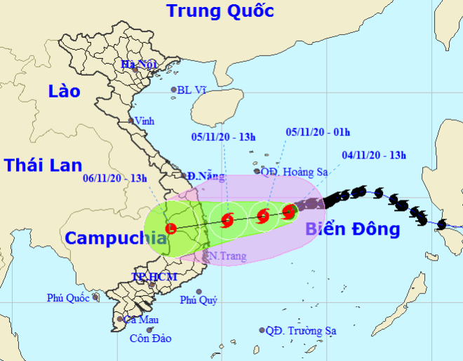
Goni could continue moving the west-southwestward, and it could weaken into a tropical depression before hitting the region from Quang Ngai to Khanh Hoa tomorrow, on Thursday, and continue to considerably downgrade its intensity into a low remnant, according to Viet Nam’s National Centre for Hydro-Meteorological Forecasting (NCHFM) latest watches and warnings.
 |
| Storm Goni tracking map (Photo: NCHFM) |
Goni is dangerous both on the mainland and at sea, with vessels operating in the affected zones bearing high risks from gusts, said Director of the National Centre for Hydro-Meteorological Forecasting Mai Van Khiem.
Rain, whirlwinds, and gusts are slashing coastal and inland areas, inflicting risks on ships and coastal aquaculture.
From Wednesday into Saturday, the storm continues bringing large-scale massive amounts of rainwater to Central Viet Nam which was heavily battered by devastating storms and floods last month.
Of special note, the south-central localities of Quang Nam, Quang Ngai and Binh Dinh could be soaked by the heaviest downpours of 150-300mm in average volume.
Meanwhile, Thua Thien Hue, Da Nang, Phu Yen, Kon Tum and Gia Lai will see lower amounts falling over the next few days with only 150-200mm.
River flood warning has been issued for the region from Ha Tinh to Khanh Hoa and Central HighlandsFrom Thursday through Saturday, water levels could reach alert levels 1-2 in rivers in the localities of Ha Tinh, Quang Binh, Quang Tri, Thua Thien Hue, Khanh Hoa and Kon Tum, whilst levels 2-3 in the region from Quang Nam to Phu Yen and the Central Highlands province of Gia Lai, with some rivers there exceeding alert level 3.
From Wednesday into Friday, the region from Nghe An to Quang Tri could experience 150-300mm of rain.
By HOANG HIEP – Translated by A.T