Storm Koguma weakens into tropical depression after hitting northern localities
Storm Koguma, the second storm to have entered the East Sea this year, weakened into a tropical depression Sunday morning, hours after making landfall in the coastal area from northern Hai Phong to north central Nghe An, the National Centre for Hydro-Meteorological Forecasting (NCHMF) freshly said.
 |
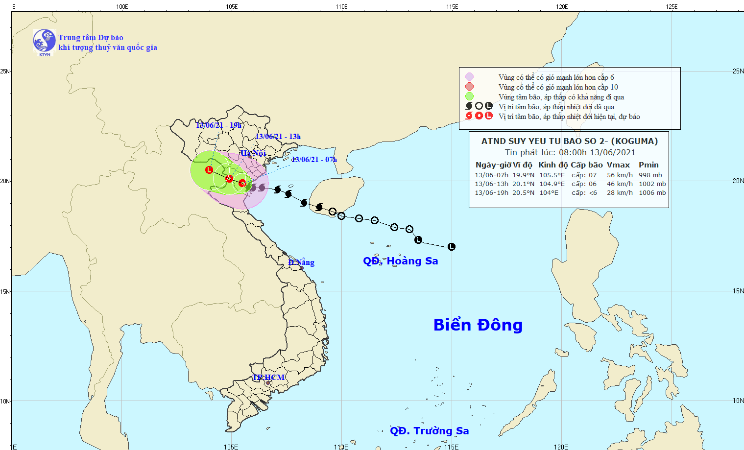
| The expected track of the tropical depression degrading from storm Koguma (Source: Viet Nam’s National Centre for Hydro-Meteorological Forecasting) |
Koguma made landfall at 3:00a.m. and get downgraded to a tropical depression by 7:00a.m. over the north central province of Thanh Hoa, with maximum wind speed of 60 kph.
The depression is now traveling westwards and highly likely to reach the Laos border at 1:00 p.m., and quickly lose its power.
For the time being, strong winds and heavy rainfall are lashing areas along northern and north-central coastal areas.
The northern delta, midland and areas from Thanh Hoa to Ha Tinh provinces are experiencing heavy to torrential rain accompanied by thunderstorms, with an average rainfall of 50-120mm till the end of today. Some places are likely to even record an excessive rainfall of 200-250mm and above.
Previously, this year’s first storm, Choi-wan, made landfall in Taiwan on June 4.
According to projections recently released by the Mid-Central Region Centre for Hydro-meteorological Forecasting, this year’s rainy season is highly likely to begin early and end later than previous years. In particular, up to 13 storms operating in the East Sea, of which six could hit the mainland of Viet Nam, with up to four affecting Da Nang's weather conditions.
From Monday into Thursday, June 17, Da Nang is expected to see the temperature hovering at 27– 34 degrees Celsius, and it is highly likely to see its mercury rise over the subsequent days, NCHMF said.
Reporting by NCHMF- Translating by A.T