Heavy rains cause Yen and Cam Le rivers to overflow
The Yen and Cam Le rivers burst their banks on Saturday morning, October 23 after heavy rains lashed Da Nang since Friday evening, sending a huge volume of water to flood some low-lying roads along the rivers. In addition, 12 small reservoirs in the city are full of water and some of them are likely to overflow.
The Da Nang Steering Committee for Disaster Response and Search and Rescue has warned that the city will continue to witness moderate rainfall from Saturday into next Monday, October 25 with possibility of heavy rains in some places. There will be a gradual decrease in rainfall over Da Nang after next Monday. The total rainfall amount will be 50-100 mm in common in Da Nang and more than 150mm of rain could fall in some parts of the city.
The Committee has also issued watches and warnings for flash floods and landslides in Hoa Bac and Hoa Phu communes in Hoa Vang District, especially in Pho Nam and Ta Lang villages in Hoa Bac Commune, in Hoa Lien and Hoa Son communes, Hoa Vang District, especially on the DT.601 route, the section adjacent to the tunnel connecting the south of Hai Van Pass with Tuy Loan section in Hoa Lien Commune and the So Mountain in Hoa Son Commune.
Low-lying areas, especially in Lien Chieu, Thanh Khe, Hai Chau, Son Tra, Ngu Hanh Son, Cam Le districts could face localized flooding risks.
Currently, the following reservoirs in Da Nang are full of water: Truong Dong, Hoc Gii, Tan An, Dieu Phong, Hoa Khe, Ho Gao, Ho Thung, Dong Treo, Truong Da Bac, Ho Cai, Ho Tray, Ho Cau. Such lakes as Phu Tuc, Hoc Khe, Hoa Trung will likely to burst their banks.
The Da Nang Steering Committee for Disaster Response and Search and Rescue is urging authorities at local level and relevant agencies to continue to take proactive and necessary mitigative measures in response to northeast monsoon and heavy rain which could trigger flash floods and landslides in mountainous areas and flooding in low-lying and riverside areas.
Viet Nam’s National Center for Hydro-meteorological Forecasting has said that from Saturday into next Monday, October 25, the water level on the Vu Gia River in Quang Nam Province to reach at alarm level 2 and level 3, while that on the Thu Bon River in the same province and rivers in Binh Dinh, and the Dakbla River in Kon Tum will likely to reach at alarm level 1 and level 2, and some rivers will reach at alarm level 2.
Forecasters have also issued warnings of flash floods and landslides for mountainous areas, and flooding alerts are in place in low-lying, riverside and urban areas in the parts from Thua Thien Hue to Quang gai.
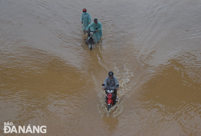 |
| Overflowing Cam Le River causes flooding low-lying section on Thang Long Street. Photo: HOANG HIEP |
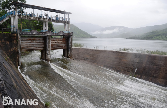 |
| The water level in the Dong Nghe Lake is rising. Photo: HOANG HIEP |
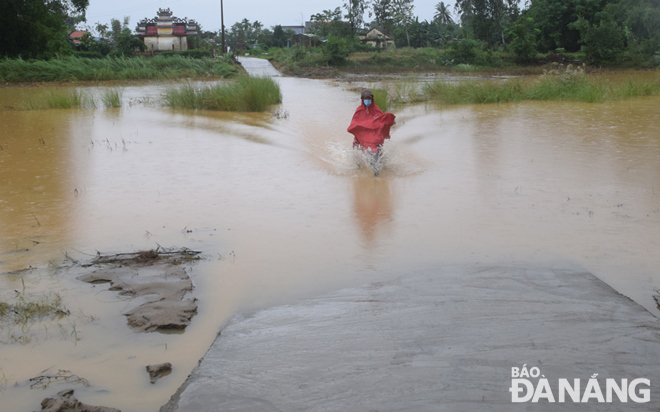 |
| The Yen River has burst its banks causing floods in a road connecting Hoa Tien Commune in Hoa Vang District to Dien Tien Commune in Dien Ban Town, Quang Nam Province. Photo: HOANG HIEP |
Reporting by HOANG HIEP – translating by H.L