
Wet and cold weather continues in Da Nang
Rainy and cold conditions are prevailing in Da Nang, according to the Mid-Central Region Centre for Hydro-meteorological Forecasting.
From Wednesday night into Thursday morning, Da Nang saw scattered moderate rainfall while some places like Tho Quang Ward in Son Tra District, Thac Gian Vinh Trung, An Khe wards in Thanh Khe District experienced heavy to very heavy falls.
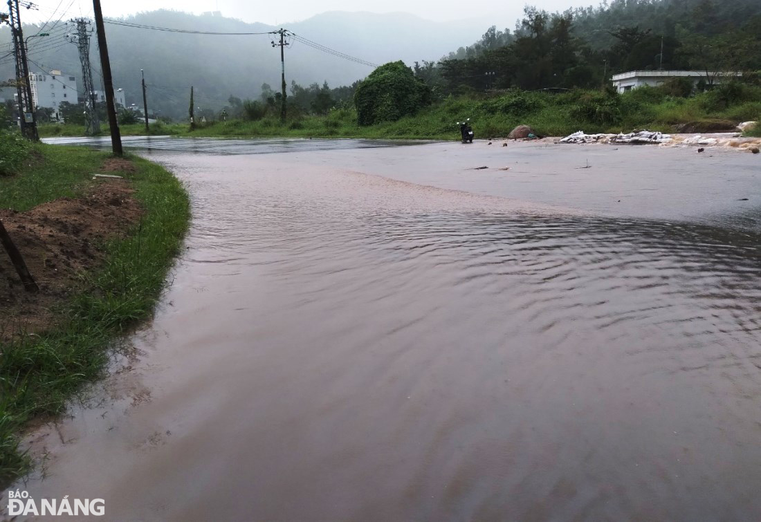 |
| Heavy rains resulted in water-logging in Le Van Luong Street in Tho Quang Ward, Son Tra District. Photo: HOANG HIEP |
As per the regional weather service, Da Nang could continue to witness scattered moderate rain with some areas experiencing very heavy rainfall on Thursday. The total rainfall amount is expected to reach 20mm to 50mm in common, and even over 80mm possible in some places.
By the coastal areas they will see high winds at level 4 and farther inland you could find gradually increasing northeasterly wind at level 3.
The coolest temperatures are in the early morning and at night across Da Nang.
Da Nang is under the influence of intense cold wave as the minimum temperature is likely to settle in the range from 17 to 21 degrees Celsius in Hoa Vang and Cam Le districts, 19 to 22 degrees Celsius in Son Tra and Ngu Hanh Son districts, and 18 to 22 degrees Celsius in Lien Chieu, Thanh Khe and Hai Chau districts.
The open waters off the Da Nang Coast could experience strong northeasterly winds at level 6, sometimes at level 7, and the gusts reaching level 8, as well as rough seas with waves as high 3-5m.
Friday into Sunday, light to moderate rainfall at most places with isolated heavy to very heavy rainfall and thunderstorms is likely over Da Nang.
Thunderstorms can produce strong winds, lightning, hail and tornadoes, the regional forecasters warned.
Forecasters warned that heavy rain will increase the risk of flash floods and landslides in mountainous areas, as well as flooding in low-lying and urban areas.
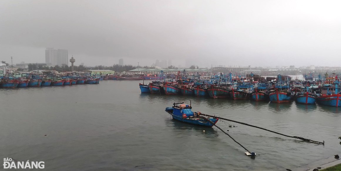 |
| Fishing boasts docked at the Tho Quang Fishing Wharf amid strong winds at sea. Photo: HOANG HIEP |
Meteorologists at Viet Nam’s National Center for Hydro-meteorological Forecasting (NCHMF) continue to monitor a new tropical depression which has been downgraded from tropical Storm Jelawat (named "Kabayan" in the Philippines).
Forecast models indicate that at 7:00am on Thursday, December 21, the depression's centre was spotted near latitude 8.4 North, longitude 112.7 East, sat over the Truong Sa Islands, packaging maximum sustained winds reaching level at 6, and the gusts as high as level 8.
The system changed its direction and moved toward the southwest at about 15 kilometers per hour while gradually weakening into a remnant low.
On Friday morning, December 26, what remains of Tropical Storm Jelawat will be centered near 6.2 North, longitude 110.6 East, lie to southwest of the Truong Sa Islands. Continued weakening is forecast, and the remnant low is expected to dissipate.
Reporting by HOANG HIEP- BAOTINTUC – Translating by H.L


