Storm Vamco brings chaos to Da Nang
Despite the prediction that Da Nang would not be directly impacted by violent storm Vamco, Da Nang government took a series of proactive responses to the threat of flooding and landslides triggered by the powerful storm.
As a result, Da Nang did not suffer major structural damage from storm with few fallen trees, and no reports of inundated major streets. Only some coastal streets, plus ones along the both banks of the Han River, have been damaged by big waves and a rise in sea and river levels. Included are Nhu Nguyet, Vo Nguyen Giap, Hoang Sa and Nguyen Tat Thanh streets.
Below photos have captured just a glimpse of the damage across Da Nang caused by strong winds and heavy rain as a result of the impacts of powerful storm Vamco.
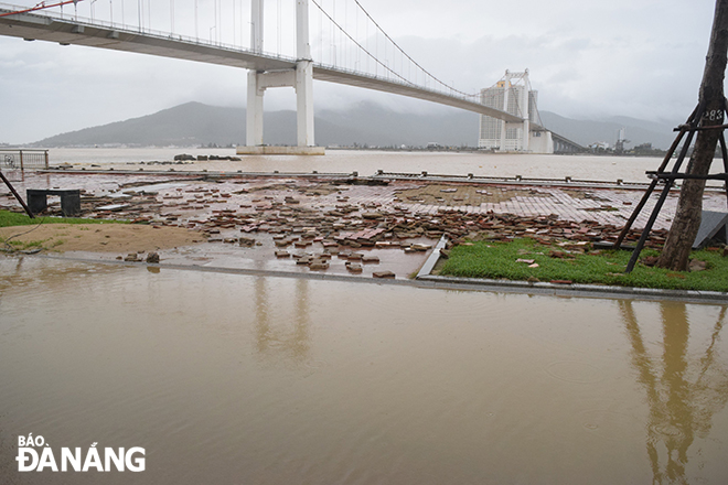 |
| The pavement of Ngu Nguyet Street was damaged by strong winds and a rise in river level. |
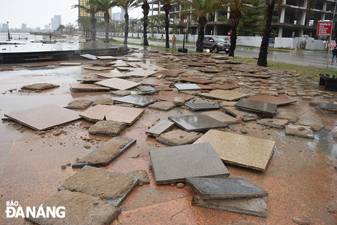 |
| Nhu Nguyet Street's pavement peeling off |
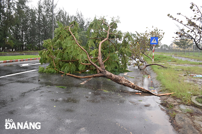 |
| Uprooted trees on Nguyen Tat Thanh Street |
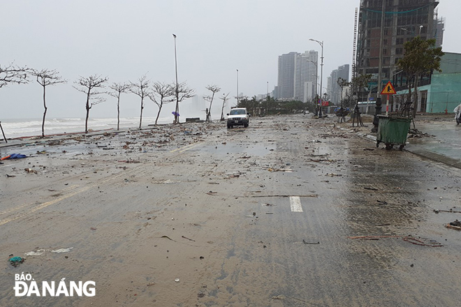 |
| A lot of trash and sea sand washed onto the Vo Nguyen Giap-Hoang Sa Street by sea waves |
Typhoon Vamco weakened into a tropical storm as it ripped through Quang Tri-Thua Thien Hue early Sunday morning with life-threatening conditions expected to last throughout the day.
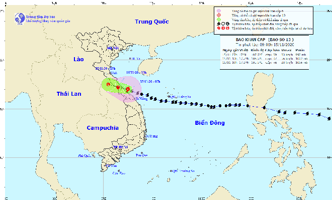 |
| Storm Vamco tracking map (Photo: The National Centre for Hydro-Meteorological Forecasting) |
The depression is moving the west-northwestward at about 15-20kph, with maximum sustained winds of level 9 (90kmp) near its centre.
At 1pm today, on Sunday, the centre of the depression will be located near latitude 17°2’N and longitude 106°5’E, right on the Viet Nam-Laos border area.
Over the next 6 - 12 hours, the depression is projected to continue racing the west-northwestward at about 15-20kph, and it continues to degenerate into a remnant low.
A vast central region from Nghe An to Thua Thien Hue provinces face even more misery in the aftermath of typhoon Vamco with weather forecasters predicting another up to 300mm of rain in some parts of these localities on Sunday and Monday.
Meanwhile, northeast winds levels 6 - 7, with a gust of levels 8 - 9, and rough seas with 0.5 - 1 meter high waves are likely to be seen off the Nghe An-Thua Thien Hue coast, which might cause severe inundation in low lying residential areas in these localities.
Large swathes of Da Nang will be hit by further blustery showers and and gale-force winds into the next couple days.
By HOANG HIEP, VAN HOANG - Translated by M.D


