Vu Gia and Thu Bon rivers' downstream areas flooded due to rising water levels
Some parts of Da Nang and neighbouring Quang Nam Province are experiencing major impacts on severe flooding from swollen rivers caused by the remnants of storm Etau triggered-heavy rain.
 |
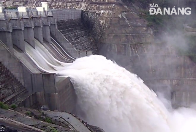
| A hydropower reservoir on the upstream of the Vu Gia River releasing floodwaters from its spillways |
Between Tuesday evening and Wednesday morning, many low-lying and riverside areas downstream the big Vu Gia and Thu Bon rivers were flooded as a result of their rising water levels.
Three hydropower reservoirs, namely Dak Mi 4, Song Tranh 2 and Song Bung 4 are managing to effectively reduce peak discharges in a bid to avoid causing further flooding troubles to the downstream areas.
At 4.00 am on Wednesday, the water level of the Vu Gia River measured at the Ai Nghia Hydrological Station rose to 8.07m, 0.07m above the alert level 2, whilst that of the Thu Bon River recorded in Cau Lau, likewise, could be 0.11m below the alert level to stand at 2.89m.
At 6.00 am on Wednesday, the water level of the Yen River upstream of the An Trach Dam has risen to 4.99m and spilled onto the river banks, which inundated some low-lying residential areas in Hoa Tien Commune, Hoa Vang District, on Wednesday morning.
Also getting stuck in the same inundation trouble, some roads across Hoa Tien Commune were submerged in water, causing travel disruption in this area.
Also problematically, warnings on landslides and floodings have also been issued for some vulnerable mountainous and low-lying areas, respectively, in wet weather-soaking central regional localitiesfrom Quang Binh and Quang Nam.
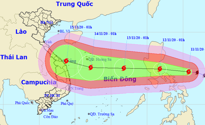
Meanwhile, storm Vamco is approaching the East Sea. At 10.00 am on 10 November, it was 770 km southeast of Luzon island in the Philippines, with winds of up to 75 km/h.
 |
| Storm Vamco tracking map |
It is forecast to enter the East Sea tomorrow, 12 November, with winds of up to 133 km/h, and will then hit Central Viet Nam on 14 - 15 November.
Of special note, AccuWeather meteorologists warn that Vamco will track within a region of light wind shear and warm ocean water, ingredients that tropical cyclones need to strengthen.
Vamco, as a result, may quickly strengthen into the equivalent of a Category 3 hurricane on the Saffir-Simpson Hurricane Wind Scale, with maximum sustained winds of 179-208 kph.
By HOANG HIEP – Translated by A.T


