Flood and landslides alerts for Da Nang
Weather warnings have been issued across Da Nang and elsewhere in the mid-central region as heavy rain is lashing down across the region under the combined effect of the newly-formed depression and a cold front.
 |
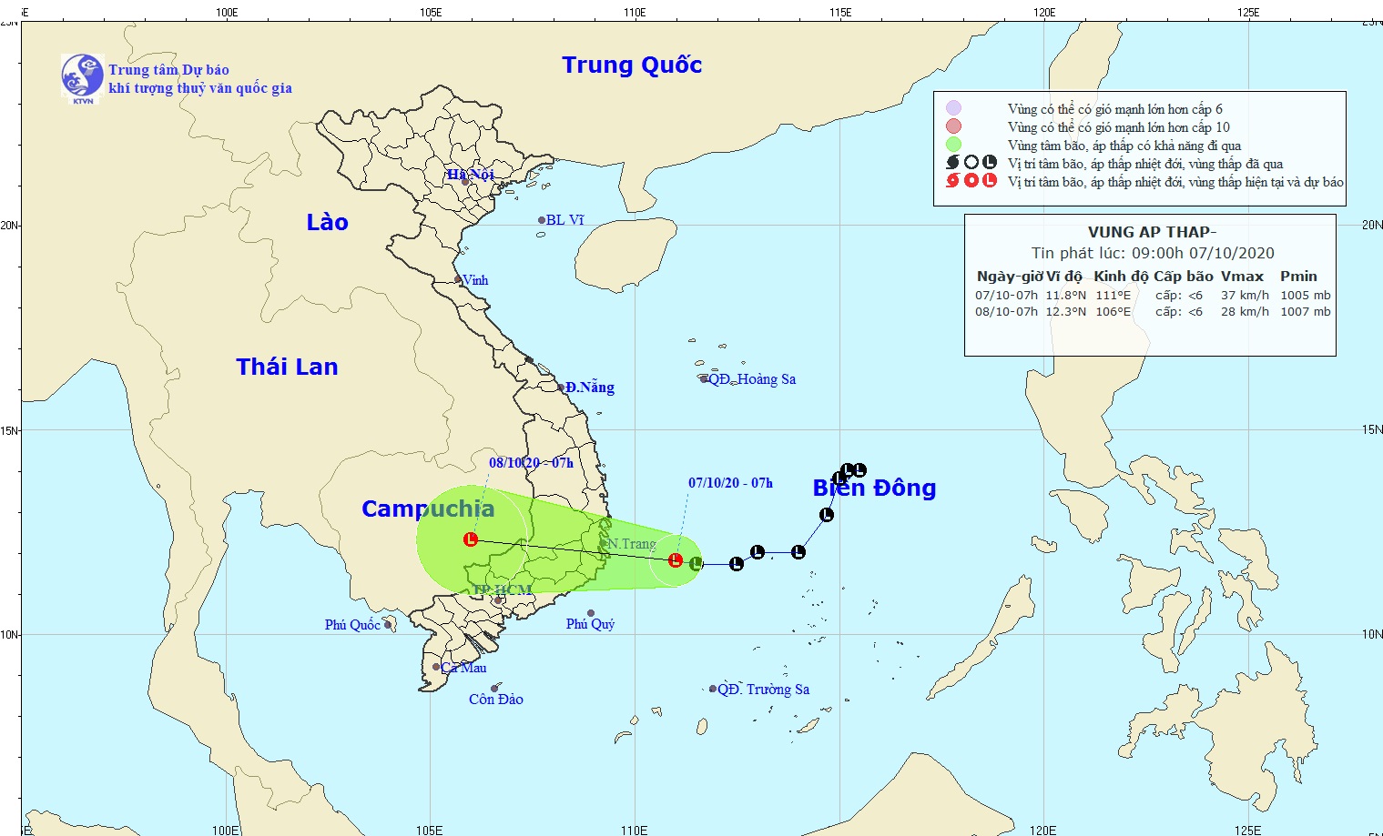
| The expected track of the depression (Source: The National Centre for Hydro-Meteorological Forecasting) |
On-going persistent downpours may cause flooding, landslides and transport disruption in the mid-central regional localities.
Coastal provinces of Ha Tinh - Quang Ngai are the worst- hit localities in the region with 500-700mm of rain recorded in 24 hours.
North highlands provinces are predicted to see 300-500mm of rainfall this week, and south highlands provinces will experience the heavy rainfall of 150 and 250mm.
A second period of downpours will follow after Sunday, with complicated development.
National weather forecasters say, at 1.00pm today, 7 October, the depression, packing strong winds at levels 6-9 near its centre, will head toward coastal provinces of Binh Dinh - Khanh Hoa.
The depression is moving mainly west at a velocity of about 15-20 kph.
Due to the strong influence of the tropical depression, the southern and central parts of the East Sea, including the Truong Sa (Spratly) Archipelago, will be likely to brace for strong winds levels 7-8, a gust of level 9, sea waves from 1.5 to 3m high, and rough seas.
The Da Nang Steering Committee for Natural Disaster Mitigation, and Control and Search and Rescue is urging relevant agencies to make all necessary preparations for tropical depression with its complicated tracks, plus widespread rain, during this week.
The Da Nang Border Guard High Command and the Coastal Information Station is responsible for keeping all fishing boats operating at sea well informed of the depression’s position, direction and movement. This will allow them to take the initiative to avoid dangerous areas.
By HOANG HIEP - Translated by M.D


