Storm with strongest winds reaching level 10 forecast to make landfall in Thai Binh - Nghe An provinces
Storm No 2, internationally known as Sinlaku, is expected to make landfall in the coastal localities from Thai Binh to Nghe An provinces in the next 12 hours, Viet Nam's National Centre for Hydro-Meteorological Forecasting has warned.
 |
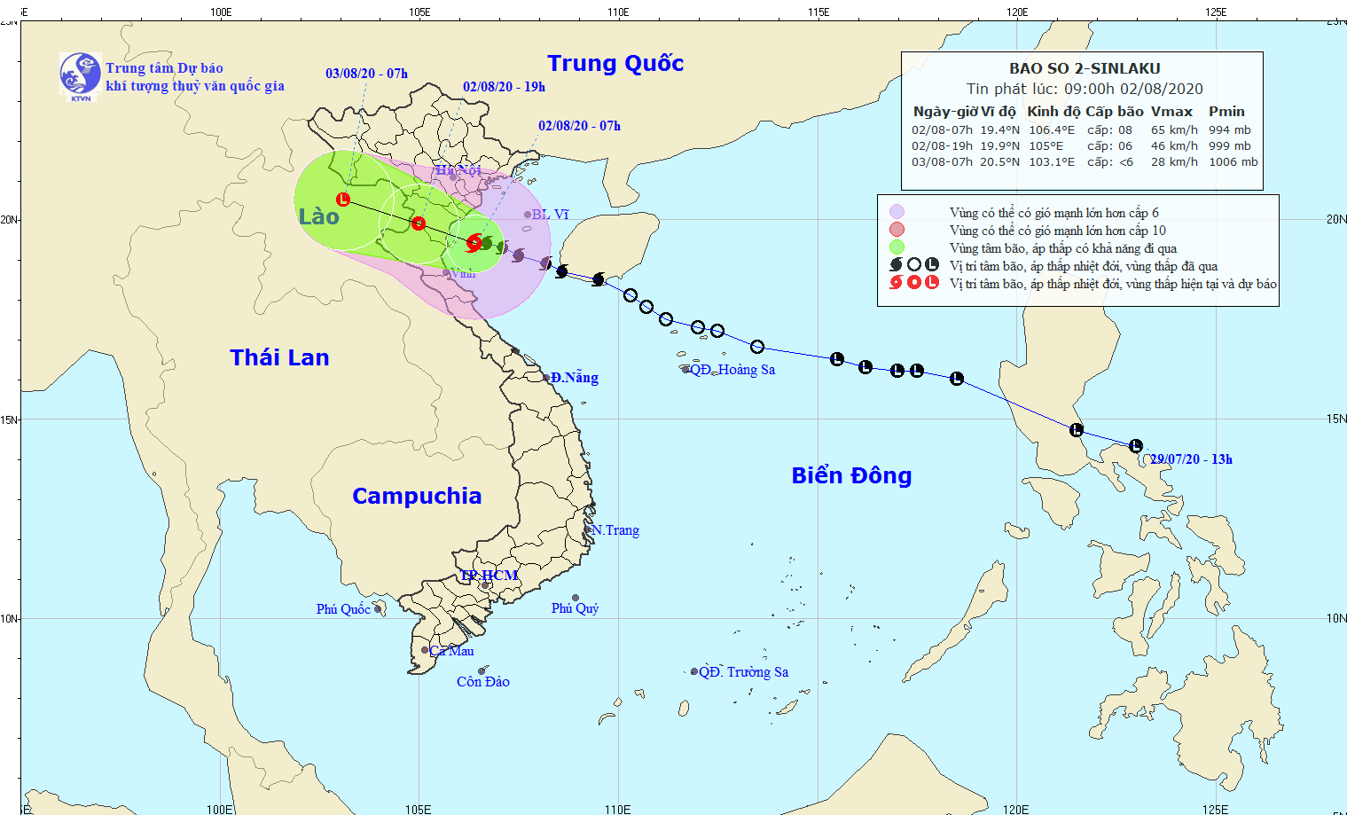
| The expected track of the storm (Source: The National Centre for Hydro-Meteorological Forecasting) |
At 7am today, 2 August, the storm’s centre was located at latitude 19°4’N and longitude 106°4’E, right on the coast of Thai Binh to Nghe An provinces, with maximum sustained wind speeds near its center reaching 60-75kph (level 8), gusting at level 10.
In the next 12 hours, the storm is predicted to move in a west- northwest direction at a velocity of 15 km an hour, and to make landfall in the localities from Ninh Binh to Nghe An provinces. After that, the storm will be weakened into tropical depression.
At 7pm today, the tropical depression will be positioned at latitude 19°9’N and longitude 105°0’E. The strongest wind speed near the depression's centre will be 40-50kph at levels 6, with a gust of level 8.
Twenty four hours later, the tropical depression is forecast to move in a west- northwest direction at a velocity of 15 km an hour, and continue to weaken into a low pressure system.
Due to the strong influence of the storm, the western part of the East Sea is experiencing heavy thunderstorms, strong winds levels 6-7, a gust of level 8, sea waves from 3 to 4 m high, and rough seas.
Today, localities from Thanh Hoa to Quang Binh embrace for moderate to torrential rain. Meanwhile, the lower rainfall is possible in localities from Thua Thien Hue to Quang Nam, including Da Nang, with scattered moderate rain reported in many of their places.
By VOV- Translated by M.D